Let AI agents run your geospatial-services apps.
The best geospatial-services connectors — deploy one and your agent operates instantly.
geospatial-services
2 appsIndustry Titans 222Superpower 27Loved by Developers 62AI Frontier 96The Unthinkable 92Money Moves 91Ship It 56Talk to Me 25Growth Engine 57Brain Trust 75Fort Knox 47Friends of MCP 55Productivity 304Developer Tools 324Data & Intelligence 9Communication 1E-Commerce 185CRM & Sales 7Databases 37Education 2Real Estate 18Other 9 Clear filters
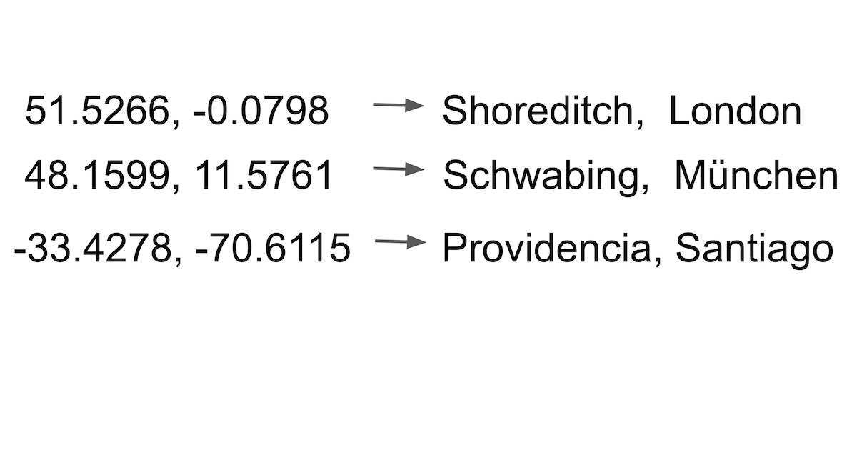
OpenCage
10 toolsGeocode addresses and reverse-geocode coordinates via OpenCage — convert locations to lat/lng and back with country, language, and privacy filters from any AI agent.
Jawg Maps (Location & Routing)
10 toolsBuild with location data via Jawg Maps — search places, calculate routes, compute distance matrices, and get elevation data.
No results found
Try adjusting your search or filters.