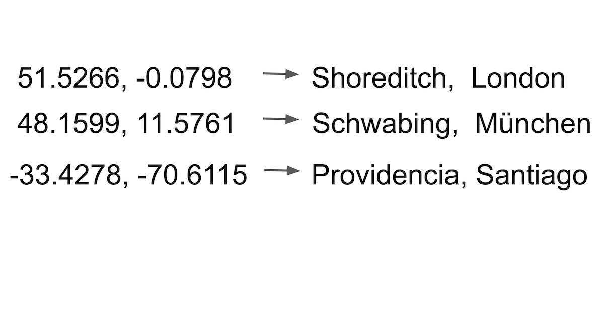
#geocoding
Conectores geocoding — implante um e seu agente opera na hora.
14 apps


#geocoding
14 appsGoogle Maps Platform
9 ferramentasGet directions, place details, geocoding, and timezone data via official Google Maps APIs.
Open-Meteo Full Access
15 ferramentasThe ultimate weather Mega-Server: 15 tools covering forecast, historical (84 years), marine, air quality, pollen, climate projections (to 2100), flood, geocoding, and elevation — all in one zero-auth integration.
ArcGIS
10 ferramentasAutomate mapping and spatial analysis via ArcGIS — perform geocoding, route solving, vehicle routing, and calculate origin-destination matrices from any AI agent.
LocationIQ (Geocoding & Maps)
10 ferramentasBuild with location data via LocationIQ — geocode addresses, calculate routes, and perform reverse lookups.
OpenCage
10 ferramentasGeocode addresses and reverse-geocode coordinates via OpenCage — convert locations to lat/lng and back with country, language, and privacy filters from any AI agent.
Geocodio
10 ferramentasEmpower geocoding via Geocodio — perform batch geocoding and reverse geocoding for US/Canada, and retrieve Census and legislative data directly from any AI agent.
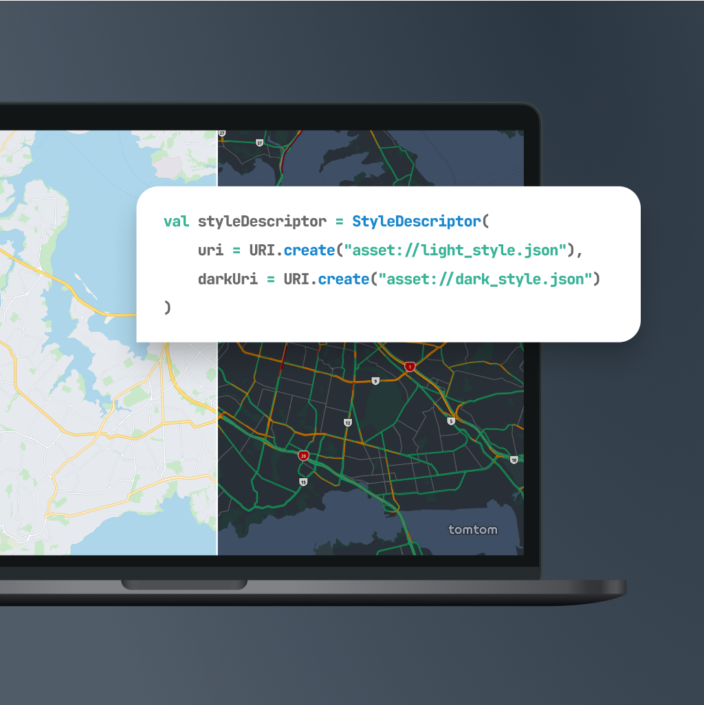
TomTom
10 ferramentasEquip your AI agent with global mapping, routing, and real-time traffic capabilities powered by TomTom.

Trimble
10 ferramentasEquip your AI agent with enterprise-grade truck routing, commercial geocoding, and advanced toll cost logistics algorithms.
Jawg Maps (Location & Routing)
10 ferramentasBuild with location data via Jawg Maps — search places, calculate routes, compute distance matrices, and get elevation data.
OpenRouteService
10 ferramentasPlan routes and analyze spatial data via OpenRouteService — calculate directions, isochrones, distance matrices, VRP optimization, and geocoding from any AI agent.
Pelias Geocoder
10 ferramentasMap geospatial structures via Pelias APIs — convert coordinates, perform reverse geocoding, autocomplete POIs, and retrieve addresses natively by AI logs.

Precisely
10 ferramentasEquip your AI with precise location intelligence — geocode addresses, resolve property risks, calculate local taxes, and analyze demographics globally.

Smarty
7 ferramentasEquip your AI with enterprise-grade location intelligence to validate, autocomplete, and extract US or International addresses instantly.

HUD User (USPS Crosswalk)
10 ferramentasMap ZIP codes to Census geographies via HUD User USPS Crosswalk API.