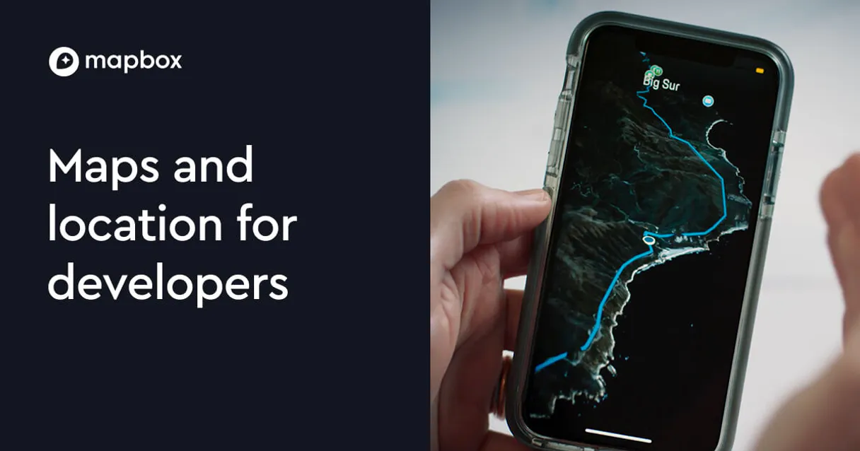
Mapbox MCP. Calculate optimal routes and spatial data on demand.
 Gemini
 Works with every AI agent you already use
…and any MCP-compatible client
Just plug in your AI agents and start using Vinkius.
Mapbox (Maps & Geospatial) connects location intelligence—geocoding, routing, and spatial analysis—directly into your AI agent. Use `search_places` to find coordinates, run `get_directions` for travel paths with real-time traffic data, or use `solve_optimization` to determine the most efficient multi-stop route automatically.
What your AI agents can do
Generate static map
Creates a simple image URL of a map centered on specific coordinates.
Geocoding session
Performs autocomplete searches for addresses and locations as the user types them into an input field.
Get directions
Calculates detailed turn-by-turn driving, walking, or cycling directions between two points.
Determine optimal driving, walking, or cycling routes between a defined start and end point.
Figure out the shortest path that visits a set of coordinates in the most efficient order using solve_optimization.
Calculate polygons (isochrones) showing all points accessible within a given time limit and mode of travel.
Convert human-readable text into precise geographical coordinates, or vice versa using search_places and reverse_geocode.
Generate a comprehensive matrix detailing the distance and travel time between every point in two groups using get_distance_matrix.
Ask AI about this MCP
Supported MCP Clients
Gemini Waiting for input…
Mapbox (Maps & Geospatial) MCP Server: 10 Tools
These tools allow you to calculate distances, find optimal routes, generate map images, and perform advanced spatial analysis using a single agent command.
019d75cegenerate static map
Creates a simple image URL of a map centered on specific coordinates.
019d75cegeocoding session
Performs autocomplete searches for addresses and locations as the user types them into an input field.
019d75ceget directions
Calculates detailed turn-by-turn driving, walking, or cycling directions between two points.
019d75ceget distance matrix
Computes a comprehensive table of travel time and distance between multiple pairs of locations.
019d75ceget elevation
Queries the precise altitude data for any given coordinate point on Earth.
019d75ceget isochrones
Computes and returns polygons that define all areas reachable within a specific travel time limit.
019d75cereverse geocode
Takes a coordinate point and finds the corresponding human-readable address or place name.
019d75cesearch places
Searches for specific points of interest, addresses, or business names using Mapbox's geocoding database.
019d75cesnap to road
Cleans up a sequence of GPS coordinates by snapping them onto the nearest official road network path.
019d75cesolve optimization
Determines the absolute best order to visit multiple stops, solving the Traveling Salesperson Problem (TSP).
Choose How to Get Started
Build a custom MCP for your own tools, or connect a ready-made integration from our catalog.
Build Your Own
Turn any API into an MCP. Import a spec, define Agent Skills, or deploy with MCPFusion.
- Import from OpenAPI, Swagger, or YAML specs
- Create Agent Skills with progressive disclosure
- Deploy to edge with MCPFusion framework
- Built in DLP, auth, and compliance on every call
- Real time usage dashboard and cost metering
- Publish to catalog or keep private
Make Your AI Do More
Start with Mapbox (Maps & Geospatial), then connect any of our 4,700+ other servers whenever your AI needs more. One click, no limits.
- Use this MCP plus 4,700+ others, all in one place
- Add new capabilities to your AI anytime you want
- Every connection is secured and compliant automatically
- Track usage and costs across all your servers
- Works with Claude, ChatGPT, Cursor, and more
- New servers added to the catalog every week
What you can do with this MCP connector
Yo, forget those clunky API calls. You connect your Mapbox account to your AI agent and you just tell it what you need—that's it. Your agent handles all the complicated geocoding, routing, and spatial analysis on its own.
Finding Locations & Addresses:
Need coordinates? You can use search_places to search for specific points of interest, addresses, or business names using Mapbox’s massive database. If you're typing an address into a form, geocoding_session handles the autocomplete magic so you don't have to type everything out yourself. Conversely, if you only have latitude and longitude—a raw GPS point—you use reverse_geocode to figure out the exact street address or place name it corresponds to.
Mapping Out Journeys & Paths:
You can calculate detailed turn-by-turn directions for driving, walking, or biking between two specific spots using get_directions. When you're dealing with a fleet of vehicles or coordinating multiple pickups, get_distance_matrix compiles a huge table. It gives you the total travel time and distance between every single pair of locations in two groups—it’s comprehensive.
Solving Complex Logistics:
Don't just calculate one route; figure out the absolute best order to hit multiple stops. You use solve_optimization for that; it solves the Traveling Salesperson Problem (TSP) and determines the most efficient sequence possible, cutting down your total travel time dramatically. For cleaning up messy location data, especially noisy GPS traces, you run snap_to_road, which snaps those coordinates right onto the nearest official road network path.
Deep Spatial Analysis:
Want to know what's actually reachable? You calculate polygons using get_isochrones. This tool shows all the areas accessible within a specific time limit, whether you’re walking or driving. If you need altitude data for any point on Earth—like knowing how high up that spot is—you query it with get_elevation.
When your route needs to connect points across multiple origins and destinations, you rely on get_distance_matrix to process the entire set of locations into a single, usable travel time matrix.
Visualizing & Outputting Data:
You can generate simple map images using generate_static_map, just by giving it the coordinates where you want the map centered. It's clean and quick. Everything you need—from finding raw points of interest to figuring out the optimal multi-stop sequence, calculating reachability polygons, or generating a static image—is right here.
How Mapbox MCP Works
- 1 Subscribe to this server and provide your Mapbox Access Token.
- 2 Your AI client (Claude, Cursor, etc.) references the necessary tool—say,
get_directions—and passes it a list of origin/destination points. - 3 The MCP Server executes the function call, fetches real-time geospatial data from Mapbox, and returns structured results like GeoJSON coordinates or distance matrices to your agent.
The bottom line is: you tell your AI client what you need—a route, an area polygon, a list of addresses—and it handles the complex API calls for you.
Who Is Mapbox MCP For?
Developers who build location-aware apps. Logistics managers running multi-stop delivery routes daily. Data analysts cleaning and enriching large GPS datasets that need precise coordinate metadata.
Uses the server to calculate distance matrices for a fleet, figuring out which hub can service the most stops with minimum total travel time.
Integrates geocoding and routing into an application backend, relying on get_directions and search_places to validate user inputs before saving them.
Runs isochrone analysis (get_isochrones) to model service areas or uses snap_to_road to clean up noisy field-collected GPS tracks for accurate reporting.
What Changes When You Connect
- Eliminate manual route planning. Instead of copying coordinates into multiple mapping tools, you simply ask your agent to run
get_directionsfor a path from New York to Philadelphia, including current traffic-aware ETAs. - Stop guessing the best order for stops. The
solve_optimizationtool solves the Traveling Salesperson Problem (TSP), ensuring that when your agent plans a multi-stop route, it always uses the most efficient sequence possible. - Enrich raw location data immediately. You can run
reverse_geocodeon any GPS point to instantly get the corresponding street address or POI name for reporting, without needing a separate database lookup. - Model service areas accurately. Use
get_isochroneswhen you need to know what an area is within 15 minutes walking distance of—it gives you the polygon, not just a point. - Handle messy field data instantly. If your team collected GPS traces that are slightly off-road or noisy, run
snap_to_roadto clean them up and align them perfectly onto the actual road network.
Real-World Use Cases
Optimizing a delivery day for 10 stops
A logistics manager needs to service 10 different clients in one city. Instead of manually testing every permutation, they ask their agent to run solve_optimization on the list of coordinates. The agent returns the single optimal sequence, minimizing fuel costs and driver time.
Verifying a field data collection point
A data analyst gets a GPS coordinate from a sensor that's slightly off-road. They run snap_to_road on the coordinates to correct them, ensuring the recorded location is accurately aligned with the public road network before they use it for billing.
Building an emergency service radius map
An urban planner wants to know which neighborhoods are reachable by ambulance within 10 minutes. They run get_isochrones using walking/driving times, generating a precise polygon that defines the full service area for planning.
Calculating all travel options between two city branches
A company needs to compare driving time versus cycling time across three major hubs. They use get_distance_matrix with multiple origins and destinations, getting a clean comparison table of travel times and distances for the board meeting.
The Tradeoffs
Treating all points equally
Just asking the agent to find directions between A, B, and C using only get_directions three times. This calculates three separate routes, but doesn't tell you which order is fastest.
→
To find the absolute quickest path that hits all three points, use solve_optimization. It handles the entire sequence calculation for you.
Ignoring traffic conditions
Calculating a route using only basic coordinates without considering real-time data. The agent gives an ETA of 30 minutes when rush hour is making it 60.
→
Always use get_directions because that tool incorporates current, live traffic data into the estimated travel time.
Assuming a single point lookup is enough
Only using search_places to find coordinates for an address. This gives you a good starting guess, but doesn't help with surrounding area analysis.
→
After finding the point via search_places, run get_isochrones or get_distance_matrix to analyze the surrounding area relative to other points.
When It Fits, When It Doesn't
Use this server if your problem is inherently geographic. You need coordinates, routes, or spatial measurements. Don't use it if you just need simple data filtering (use a database query tool instead). The critical decision point is complexity:
* Need A Single Path? Use get_directions for turn-by-turn paths with traffic.
* Need the Best Order for Multiple Stops? You must use solve_optimization. This handles the entire sequence calculation, which is far more complex than simply listing points.
* Need to Know the Service Area? Use get_isochrones or get_distance_matrix. These tools define a boundary or measure relationships between many points simultaneously.
If your goal is just finding an address, start with search_places, but remember that the real power comes from chaining these specific tools together to solve complex logistical problems.
Independent Platform Disclaimer: Vinkius is an independent platform and is not affiliated with, endorsed by, sponsored by, verified by, or otherwise authorized by Mapbox. All third-party trademarks, logos, and brand names are the property of their respective owners. Their use on this website is strictly for informational purposes to identify service compatibility and interoperability.
VINKIUS INFRASTRUCTURE
Cloud Hosted
Managed infra
V8 Isolated
Sandboxed per request
Zero-Trust Proxy
No stored credentials
DLP Enforced
Policy on every call
GDPR Compliant
EU data residency
Token Compression
~60% cost reduction
Works with Claude, ChatGPT, Cursor, and more
The Model Context Protocol standardizes how applications expose capabilities to LLMs. Instead of operating in isolation, your AI gains direct access to external platforms, live data, and real-world actions through secure, standardized connections.
This server provides 10 capabilities that interface natively with Claude, ChatGPT, Cursor, and any MCP client. No middleware. No custom integration required.
Available Capabilities
Dealing with location data usually means switching between three different systems: GIS software, spreadsheet lookups, and multiple API calls.
Today, if you need to validate a route or analyze service areas, you're stuck. You might export raw GPS points into Excel, run them through a separate geocoding tool just to get readable addresses, then manually cross-reference the results against another mapping API to calculate distance matrices—all while hoping your data doesn't have any gaps.
With this MCP server, you don't do that. You tell your agent: 'Give me the best route between these 15 points.' The agent runs `solve_optimization` and returns a single, clean JSON object with the optimal order and total travel time. It’s instant.
The Mapbox MCP Server gives you precision using tools like get_isochrones and solve_optimization.
Before, calculating a service area meant running complex GIS software or making multiple calls to estimate different radii. You were always guessing at the geometry or limiting yourself to simple circles instead of realistic travel-time polygons.
Now, you specify 'What areas are within a 15-minute walk?' and the agent uses `get_isochrones` to give you the exact reachable polygon. That’s a massive jump in functional precision.
Common Questions About Mapbox MCP
How do I find coordinates using search_places? +
You ask your agent to use search_places and provide the address or POI name. It runs the lookup and returns a precise latitude/longitude pair, which you can then pass to other tools like get_directions.
What's the difference between get_distance_matrix and solve_optimization? +
get_distance_matrix calculates travel time between all pairs of points, giving you a comprehensive table. solve_optimization takes that data and figures out the single best order to hit all those stops.
Can I clean up messy GPS tracks using snap_to_road? +
Yes. You feed the agent the noisy or distorted GPS trace, and it runs snap_to_road. This aligns every coordinate point perfectly onto the nearest official road network path.
How do I calculate a service area radius using get_isochrones? +
You specify the center point and then provide the required travel time (e.g., '15 minutes walking'). The agent uses get_isochrones to compute the exact reachable polygon for you.
What inputs does `get_elevation` require to query accurate altitude data? +
It needs a precise geographical coordinate pair (latitude, longitude). The input coordinates must be valid floating-point numbers. We don't process approximate locations; the accuracy of the elevation result depends entirely on the precision of the point you provide.
How do I authenticate and manage my credentials when using `geocoding_session`? +
You must first subscribe to the server and supply your unique Mapbox Access Token. This token is used by your AI client to establish a secure session, allowing subsequent calls like search or autocomplete to function correctly.
What parameters can I use to customize an image when calling `generate_static_map`? +
You specify the coordinates and dimensions of the desired map output. You can also include an optional API key for attribution or specific visual overlays, ensuring the generated URL points exactly where you need it.
When should I use `reverse_geocode` instead of `search_places`? +
Reverse_geocode takes a known GPS point and tells you what that location is (e.g., an address or business name). Search_places, however, lets you search for a place using text like 'coffee shop' in a given neighborhood.
Can I calculate which areas are reachable within a 10-minute drive through my agent? +
Yes. Use the get_isochrones tool by providing the center coordinates and '10' as the minutes parameter. Your agent will return GeoJSON polygons representing the reachable areas for the specified profile (driving, walking, or cycling).
How do I optimize a delivery route with multiple stops through a conversation? +
The solve_optimization tool determines the most efficient order to visit a list of coordinates. Your agent will process the request and return the optimized sequence, minimizing either travel time or distance for your logistics workflow.
Can my agent generate a map image for a specific location? +
Absolutely. Use the generate_static_map tool by specifying the center, zoom, and resolution. Your agent will provide a usable Mapbox static image URL, perfect for visual verification without needing a mapping library.
Use it with your favorite AI tools
Connect this server to Cursor, Claude, VS Code, and more.
More in this category

Teambition
Collaborative project management platform by Alibaba — manage tasks, projects, and team workflows via AI.

Meta Ads
Equip your AI agent with direct access to Meta Ads — manage Facebook and Instagram campaigns, track ad performance, and optimize spend without opening Meta Ads Manager.

Spotio
Manage leads, pipelines, and field sales activities on Spotio with AI agents.
You might also like

JSON Merge Patch
Stop losing data when updating massive files. Apply surgical JSON patches (RFC 7396) securely to large datasets.

Orb
Automate usage-based billing via Orb — ingest events, manage subscriptions, and track invoices directly from any AI agent.

NREL Energy Data
Access renewable energy and fuel data via NREL — track fuel stations, solar resources, and utility rates directly from your AI agent.