4,500+ servers built on MCP Fusion
Vinkius

MapQuest MCP. Get routes and pinpoint any location with coordinates.

Claude Claude
ChatGPT ChatGPT
Cursor Cursor
Gemini Gemini
Windsurf Windsurf
VS Code VS Code
JetBrains JetBrains
Vercel Vercel
See Vinkius in Action

Works with every AI agent you already use

…and any MCP-compatible client

MapQuest MCP on Cursor AI Code Editor MCP Client MapQuest MCP on Claude Desktop App MCP Integration MapQuest MCP on OpenAI Agents SDK MCP Compatible MapQuest MCP on Visual Studio Code MCP Extension Client MapQuest MCP on GitHub Copilot AI Agent MCP Integration MapQuest MCP on Google Gemini AI MCP Integration MapQuest MCP on Lovable AI Development MCP Client MapQuest MCP on Mistral AI Agents MCP Compatible MapQuest MCP on Amazon AWS Bedrock MCP Support

Just plug in your AI agents and start using Vinkius.

MapQuest MCP Server handles location intelligence for your AI agent. It converts addresses into coordinates, calculates turn-by-turn routes for driving, walking, or cycling, and finds points of interest nearby.

You can also map any specific location using a static image URL.

What your AI agents can do

Geocode address

Converts a full street address into precise latitude and longitude coordinates.

Get directions

Calculates travel routes, providing turn-by-turn directions for driving, walking, or cycling between two points.

Get static map url

Generates a URL that displays a static map image centered on specified coordinates.

+ 2 more capabilities included
Determine Coordinates from an Address

You pass a street address to geocode_address, and it returns the exact latitude/longitude pair.

Plan Multi-Modal Routes

The agent uses get_directions to calculate travel time, distance, and turn-by-turn instructions for cars, feet, or bikes.

Find Human Address from Coordinates

If you only have a GPS point, run reverse_geocode to get the corresponding street address.

Locate Nearby Businesses

Use search_points_of_interest to query for specific types of local spots (like car washes or coffee shops) near a point.

Generate Map Images

You feed coordinates into get_static_map_url, and it gives you an image URL ready for display.

Supported MCP Clients

Claude Claude
ChatGPT ChatGPT
Cursor Cursor
Gemini Gemini
Windsurf Windsurf
VS Code VS Code
JetBrains JetBrains
Vercel Vercel
+ other MCP clients
Free for Subscribers

Waiting for input…

AI Agent

MapQuest MCP Server: 5 Tools for Location & Routing

Run five specialized location tools with your AI client. Convert addresses, calculate routes, find nearby spots, or display static maps—all through simple commands.

geocode019d8455

geocode address

Converts a full street address into precise latitude and longitude coordinates.

get019d8455

get directions

Calculates travel routes, providing turn-by-turn directions for driving, walking, or cycling between two points.

get019d8455

get static map url

Generates a URL that displays a static map image centered on specified coordinates.

reverse019d8455

reverse geocode

Converts geographic coordinates into the most likely human-readable street address.

search019d8455

search points of interest

Finds specific types of nearby locations, like restaurants or gas stations, around a given area.

Choose How to Get Started

Build a custom MCP for your own tools, or connect a ready-made integration from our catalog.

Build Your Own

Turn any API into an MCP. Import a spec, define Agent Skills, or deploy with MCPFusion.

  • Import from OpenAPI, Swagger, or YAML specs
  • Create Agent Skills with progressive disclosure
  • Deploy to edge with MCPFusion framework
  • Built in DLP, auth, and compliance on every call
  • Real time usage dashboard and cost metering
  • Publish to catalog or keep private
Start building

Make Your AI Do More

Start with MapQuest, then connect any of our 4,700+ other servers whenever your AI needs more. One click, no limits.

  • Use this MCP plus 4,700+ others, all in one place
  • Add new capabilities to your AI anytime you want
  • Every connection is secured and compliant automatically
  • Track usage and costs across all your servers
  • Works with Claude, ChatGPT, Cursor, and more
  • New servers added to the catalog every week

What you can do with this MCP connector

This MapQuest MCP Server gives your agent location intelligence—it's basically an entire atlas bolted right onto the toolset. You use it whenever you need to know where something is or how to get there. It handles coordinates, full street addresses, points of interest (POIs), and static map images.

If you start with a physical address, your agent uses geocode_address to convert that full street name into precise latitude and longitude pairs. That's the first thing it does: pinpointing where an address is on the globe. Conversely, if all you've got are raw GPS coordinates—say, from a sensor reading—you run reverse_geocode.

This tool takes those numbers and spits out the most probable, human-readable street address for that exact spot.

When it comes to figuring out where people actually go, your agent can search for local spots using search_points_of_interest. You tell it what kind of business you're looking for—maybe a coffee shop or a gas station—and the tool returns specific nearby locations around a given point. It doesn’t just guess; it finds real types of businesses in an area.

For trip planning, get_directions is your go-to function. This calculates full travel routes between two points and gives you more than just a straight line—it provides turn-by-turn instructions for driving, walking, or biking. It also tells you the estimated distance and how long the whole thing'll take. You can calculate multi-modal routes; it works whether your agent is operating in a car, on foot, or by bike.

If you need to show someone exactly where something is, even if you don't want them to use a live map service, get_static_map_url generates that URL. You feed the coordinates into this tool, and it hands you an image URL ready for display—a static picture of the map centered right on those specific points.

It’s perfect for embedding location data directly into reports or messages without needing a live map connection.

You'll use these tools together all the time. For instance, if you need to plan a route (using get_directions), but you only have an address instead of two sets of coordinates, you first run that address through geocode_address to get your starting and ending latitude/longitude pairs. Then, you pass those resulting coordinates into get_directions.

If the trip involves finding the nearest car wash along the way, you use search_points_of_interest near a point on the calculated route. Finally, if someone needs a visual confirmation of the entire path, you feed the key coordinate points into get_static_map_url to generate the final image link.

Don't think of it as just five separate buttons. Think of it as a complete location stack for your agent. You can verify an address (using geocode_address), then figure out what that spot is called in plain English (using reverse_geocode). You can find the nearest service station nearby (via search_points_of_interest) and calculate how long you'll take to get there, whether you drive or walk (get_directions).

If you need to share a picture of the neighborhood map, get_static_map_url handles that. It’s reliable infrastructure for any task involving geography.

How MapQuest MCP Works

  1. 1 First, subscribe to the server and provide your MapQuest Consumer Key.
  2. 2 Next, tell your agent what you need—for example, 'Find gas stations near 34th Street.'
  3. 3 The agent executes the necessary tool (search_points_of_interest), gets the data back, and presents the result to you.

The bottom line is: your AI client manages the API calls; you just tell it what location job needs doing.

Who Is MapQuest MCP For?

This server is built for operational roles that deal with physical locations and movement. It’s for the logistics manager who can't afford delays due to manual coordinate lookups, or the field researcher who needs immediate local data without opening a browser. If your job involves mapping out routes or finding addresses in the real world, this is for you.

Logistics Coordinator

Using get_directions and geocode_address, they automate route planning for multiple delivery stops, ensuring efficiency.

Property Analyst

They run search_points_of_interest around a property’s coordinates to gauge local amenities or competition density.

Field Researcher

The agent uses reverse_geocode when they collect raw GPS data points and need to know the actual street address for reporting.

What Changes When You Connect

  • Calculate full travel plans instantly. Instead of opening a map, running get_directions gives the agent accurate driving, walking, or cycling times for immediate use.
  • Turn fuzzy addresses into hard data points. Use geocode_address to convert any street address into reliable latitude/longitude coordinates before feeding them into other tools.
  • Identify exactly what's nearby. Running search_points_of_interest pulls up lists of local businesses, whether you need a coffee shop or an auto repair shop.
  • See the picture without drawing it. get_static_map_url creates an image link so your agent can show a user exactly where something is located in one clean output.
  • Pinpoint the source address. If all you have is raw GPS data, reverse_geocode figures out the street address for you.

Real-World Use Cases

01

Planning a Supply Run

A logistics manager needs to service three stops. They ask their agent: 'Figure out the optimal route visiting these addresses.' The agent first uses geocode_address on all three points, then chains those coordinates into get_directions, giving the total distance and estimated time for the whole run.

02

Verifying a Client's Location

A researcher gets raw GPS data from a client. They ask: 'What address does these coordinates belong to?' The agent runs reverse_geocode instantly, providing the confirmed street address for documentation purposes.

03

Building an Event Map

You are designing an event page and need a map image. You tell your agent: 'Show me a static map of the convention center.' The agent calls get_static_map_url using the known coordinates, returning a ready-to-embed image.

04

Competitive Analysis

A local business owner wants to know what services are within two miles of their shop. They ask: 'Search for all dry cleaners and gas stations near this address.' The agent uses geocode_address first, then calls search_points_of_interest with the correct parameters.

The Tradeoffs

Trying to search by a vague area name

Asking the agent: 'What's near Downtown?' This is too broad and has no clear starting point for calculation.

Always start with coordinates or a full street address. If you need directions, use geocode_address first to establish Point A and Point B before calling get_directions.

Assuming the map is always needed

Asking for route details but not knowing if it's a car or a bike. This leads to incomplete timing estimates.

Be specific about your mode of travel (driving, walking, cycling) when you call get_directions. The tool handles the difference in calculation.

Skipping the coordinate lookup

Telling the agent to find POIs using just a partial address. This results in inaccurate or irrelevant search zones.

First, run geocode_address on the full street address. Then, use the resulting coordinates for your search_points_of_interest call.

When It Fits, When It Doesn't

Use this MapQuest server if your workflow requires any form of geospatial lookup: converting addresses to points, calculating travel routes, or finding local amenities. The key is that you need precise location data, not just general knowledge.

Don't use this if you simply need a list of cities or states; those are too broad for the API. Also, don't try to resolve complex geopolitical boundaries—it only handles standard street addresses and known POI types. If your requirement is purely about internal database records (e.g., 'what department owns this record?'), use a dedicated data retrieval tool instead.

Independent Platform Disclaimer: Vinkius is an independent platform and is not affiliated with, endorsed by, sponsored by, verified by, or otherwise authorized by MapQuest. All third-party trademarks, logos, and brand names are the property of their respective owners. Their use on this website is strictly for informational purposes to identify service compatibility and interoperability.

VINKIUS INFRASTRUCTURE

Cloud Hosted

Managed infra

V8 Isolated

Sandboxed per request

Zero-Trust Proxy

No stored credentials

DLP Enforced

Policy on every call

GDPR Compliant

EU data residency

Token Compression

~60% cost reduction

How we secure it →

Works with Claude, ChatGPT, Cursor, and more

The Model Context Protocol standardizes how applications expose capabilities to LLMs. Instead of operating in isolation, your AI gains direct access to external platforms, live data, and real-world actions through secure, standardized connections.

This server provides 5 capabilities that interface natively with Claude, ChatGPT, Cursor, and any MCP client. No middleware. No custom integration required.

Available Capabilities

geocode_address get_directions get_static_map_url reverse_geocode search_points_of_interest

Finding local spots shouldn't require opening three different apps.

Today, finding a new restaurant or gas station is tedious. You start by Googling the address, then you have to open an external mapping service, manually search for 'restaurants,' filter results, and then copy-paste those coordinates into your spreadsheet. It’s clicking across five different tabs just to get a clean list of points.

With this MCP server, that process collapses into one instruction. You tell your agent: 'Find me three highly rated Italian places within a mile.' The agent handles the geocoding and POI search in the background. You get a structured, actionable list immediately.

MapQuest MCP Server: Get accurate directions instantly.

Before this, planning a cross-state trip meant printing out paper maps and manually calculating driving time between every waypoint. If the road closed or traffic changed, you had to call someone or stop everything and check a web browser again.

Now, your agent uses `get_directions` to give real-time estimates for distance and time based on your specified mode—be it car, bike, or foot. You get the optimized route details right in the chat window.

Common Questions About MapQuest MCP

How does geocode_address work? +

The geocode_address tool takes a full street address string and returns exact latitude and longitude numbers. This is always the best first step if you only have text.

Can I calculate directions for walking using get_directions? +

Yes, absolutely. When calling get_directions, specify 'walking' as the mode of transport. The tool calculates routes optimized for foot traffic and provides a walk time estimate.

Does search_points_of_interest need coordinates? +

Yes, it does. You must first use geocode_address to get the latitude/longitude of the area you want to search around; then pass those coordinates into search_points_of_interest.

What is reverse_geocode? +

reverse_geocode does the opposite of geocoding. If you have a raw GPS coordinate (like 34.05, -118.24), it runs this tool to tell you what street address that point represents.

How do I get an image of a map with get_static_map_url? +

You pass the coordinates into get_static_map_url. The agent responds with a direct URL. You can then embed that URL anywhere in your application or document.

What credentials do I need to successfully call `get_directions`? +

You must provide a valid MapQuest Consumer Key. This key is required for authentication and must be configured in your AI client's settings before making any requests.

If the address I give to `geocode_address` is wrong, how does the server handle it? +

The tool returns a structured error response. It won't guess or fail silently; instead, you get specific status codes telling your agent exactly why the location could not be found.

Can I use `search_points_of_interest` to look for multiple types of businesses at once? +

Yes. You can pass a list of categories (like 'park', 'cafe', and 'bank') in one call. The server processes these distinct searches and returns separate results for each type.

Where do I get a MapQuest API Key? +

You can get a free 'Consumer Key' by signing up at the MapQuest Developer Network. The free tier includes a generous amount of monthly transactions.

Does it support international addresses? +

Yes, MapQuest provides global geocoding and routing coverage for most countries worldwide.
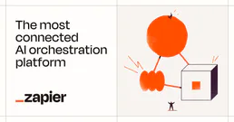
More in this category

You might also like

Built & Managed by Vinkius 30s setup 5 tools

We've already built the connector for MapQuest. Just plug in your AI agents and start using Vinkius.

No hosting. No infrastructure. No complex setup.
All 5 tools are live and waiting. You're up and running in seconds.

Claude Claude
ChatGPT ChatGPT
Cursor Cursor
Gemini Gemini
Windsurf Windsurf
VS Code VS Code
JetBrains JetBrains
Vercel Vercel
+ other MCP clients

Vinkius gives your AI agents access to the full catalog of app connectors, all fully managed, secure, and enterprise-ready. One subscription, every tool you need.

Zero hosting required Full MCP catalog included Enterprise-grade security Auto-updated by Vinkius

Built, hosted, and secured by Vinkius. You just connect and go.