Geopard Agriculture MCP for AI. Analyze real-time crop health and yield potential.
 Gemini
 Works with every AI agent you already use
…and any MCP-compatible client
Connect to your AI in seconds.
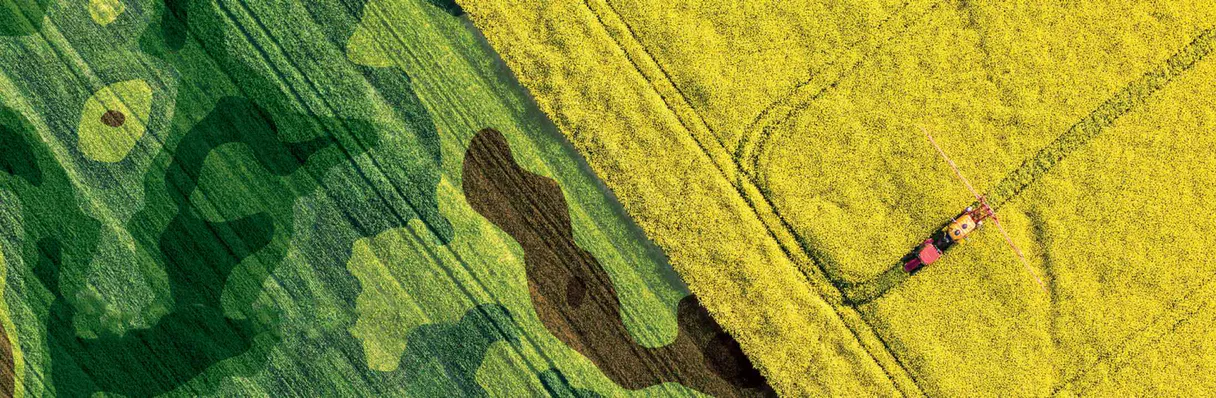
Geopard Agriculture provides deep precision intelligence for managing crops and fields. It lets your AI agent access real-time data on soil moisture levels, vegetation indices (NDVI), and current crop health layers across registered farm parcels.
Use this MCP to audit farm productivity, plan fertilizer applications, or assess resource efficiency without leaving your chat client.
What your AI can do
Get crop health data
Retrieves current indicators detailing the overall health status of planted crops.
Get field analytics
Provides detailed analytic data, including NDVI and soil moisture metrics for any specified field.
Get agri fields
Lists all registered agricultural fields and provides their specific area data.
Retrieves a complete list of all agricultural fields that have been registered with Geopard.
Fetches high-precision analytics, including NDVI scores and current soil moisture levels for specific locations.
Accesses up-to-date layers showing the general health of crops to pinpoint areas needing attention.
Aggregates past field data to help determine resource allocation trends and improvements over time.
Ask an AI about this
Waiting for input…
Geopard Agriculture: 3 Tools
Use these tools to gather everything you need—from a list of field boundaries to detailed soil moisture reports—all through one conversation.
Make your AI actually useful.
Add this MCP to Claude, Cursor, or Windsurf and your AI stops guessing. It gets real tools to look things up, take action, and handle the stuff you keep doing by hand.
Start using Geopard Agriculture on VinkiusGet Crop Health Data
Retrieves current indicators detailing the overall health status of planted crops.
Get Field Analytics
Provides detailed analytic data, including NDVI and soil moisture metrics for any...
Get Agri Fields
Lists all registered agricultural fields and provides their specific area data.
Security and governance baked right in.
Pick your AI client below to get set up. Just create a Vinkius account, subscribe, and you're instantly up and running. We handle the entire backend infrastructure, delivering out-of-the-box support for HTTPS Streamable, SSE, and OAuth2—zero messy routing required.
Claude AI
Open Claude Settings
Go to claude.ai, click your profile icon, then navigate to Customize → Connectors.
Add Custom Connector
Click the "+" button and select Add custom connector. Paste your Vinkius endpoint URL:
https://edge.vinkius.com/[YOUR_TOKEN_HERE]/mcp
Replace [YOUR_TOKEN_HERE] with your token
from cloud.vinkius.com. For OAuth-protected servers, expand
Advanced settings to add credentials.
Start a conversation
Open a new chat. The Geopard Agriculture integration is available immediately — no restart needed.
Choose How to Get Started
Build a custom MCP for your own tools, or connect a ready-made integration from our catalog.
Build Your Own
Turn any API into an MCP. Import a spec, define Agent Skills, or deploy with MCPFusion.
- Import from OpenAPI, Swagger, or YAML specs
- Create Agent Skills with progressive disclosure
- Deploy to edge with MCPFusion framework
- Built in DLP, auth, and compliance on every call
- Real time usage dashboard and cost metering
- Publish to catalog or keep private
Make Your AI Do More
Start with Geopard Agriculture, then connect any of our 5,100+ other servers whenever your AI needs more. One click, no limits.
- Use this MCP plus 5,100+ others, all in one place
- Add new capabilities to your AI anytime you want
- Every connection is secured and compliant automatically
- Track usage and costs across all your servers
- Works with Claude, ChatGPT, Cursor, and more
- New servers added to the catalog every week
Independent Platform Disclaimer: Vinkius is an independent platform and is not affiliated with, endorsed by, sponsored by, verified by, or otherwise authorized by Geopard. All third-party trademarks, logos, and brand names are the property of their respective owners. Their use on this website is strictly for informational purposes to identify service compatibility and interoperability.
VINKIUS INFRASTRUCTURE
Cloud Hosted
Managed infra
V8 Isolated
Sandboxed per request
Zero-Trust Proxy
No stored credentials
DLP Enforced
Policy on every call
GDPR Compliant
EU data residency
Token Compression
~60% cost reduction
Works with Claude, ChatGPT, Cursor, and more
The Model Context Protocol standardizes how applications expose capabilities to LLMs. Instead of operating in isolation, your AI gains direct access to external platforms, live data, and real-world actions through secure, standardized connections.
This connection provides 3 powerful capabilities that interface natively with Claude, ChatGPT, Cursor, and other compatible AI platforms. No middleware. No custom integration required.
Daily field reports are a nightmare of copy-pasting and cross-referencing.
Right now, if you want to check on multiple fields—say, your corn and your pasture—you open the GIS platform. You pull up Field A's metrics, then switch tabs, find Field B’s moisture report, copy the NDVI score into a spreadsheet, and then manually compare it against last year's yield data from an old PDF. It takes hours just to build one basic comparative chart.
With this MCP, you ask your agent for the comparison directly. You tell it which fields you want analyzed, and it pulls all that sensor data—the moisture levels, the health scores, the historical performance—and gives you a single summary report. You don't move a finger; you just get the answer.
Getopard Agriculture MCP: Actionable Intelligence for Every Acre
The specific steps that vanish are the manual data lookups and comparisons. You never have to run reports on one tool, then open a second dashboard, and finally export the numbers into a third system just to compare them. The agent handles the whole pipeline.
What's different is the shift from 'data collection' to 'decision making.' You aren't looking at data; you're getting immediate recommendations for where to apply resources.
What your AI can actually do with this
Managing large tracts of land requires more than just looking at a map; it demands technical data—soil composition, water stress levels, and historical growth rates. This connector gives your agent the ability to pull that high-resolution intelligence directly. You can get a full inventory of every managed field, check specific analytics like NDVI or soil moisture for any given coordinate, and access current crop health layers.
Whether you're optimizing nutrient application or just auditing last season's performance, it acts like having an agronomist on call. Because Vinkius hosts this MCP within the catalog, your agent connects once and gains immediate access to all these powerful field tools.
019d843f-9b85-70d3-bd28-de71f056545f Here's how it actually works
The bottom line is you get a conversation layer over complex geospatial sensor readings.
First, subscribe to the Geopard MCP on Vinkius and enter your API key.
Next, tell your AI agent what you need—for example, 'List all my fields.'
The agent calls the necessary tool, retrieves the data (like soil moisture or field boundaries), and delivers an easy-to-read summary back to you.
Who is this actually for?
This MCP is for agronomists and farm managers who deal with massive amounts of technical, location-specific data. You're the person who gets tired of switching between GIS software, Excel sheets, and field reports just to figure out where the biggest yield losses are coming from.
Uses the MCP to pull reliable technical data for decision support. They use the tools to cross-reference current crop health with historical performance before advising a client.
Checks field boundaries and current soil moisture levels in real-time. They need immediate answers on where to apply water or fertilizer next week.
Integrates the precise agriculture data into custom applications, using the MCP's structured outputs for building new features.
What Changes When You Connect
Pinpoint stress zones instantly. Instead of manually reviewing satellite images, you can use the agent to access current crop health layers, quickly identifying exactly where water or nutrients are needed.
Compare past performance to present conditions. By calling get_field_analytics, you pull historical data that lets your agent predict potential yield variance for a given area.
Manage field assets simply. The ability to use the get_agri_fields tool means you don't have to keep track of every parcel ID; just ask for a list and start working immediately.
Streamline resource allocation. You can combine data sources—like checking soil moisture from get_field_analytics against current health indicators—to build precise irrigation schedules.
Audit farm records easily. Summarizing historical field performance lets you quickly assess which years or sectors provided the best return on resources.
See it in action
Diagnosing unexpected yield drops
A farmer notices a drop in predicted yields for 'Corn Sector A'. They ask their agent to check this. The agent runs get_field_analytics, finds the historical dip, and then uses get_crop_health_data to show that water stress is currently affecting the same coordinates.
Planning next season's fertilizer spread
An agronomist needs to know where to spend money. They first use get_agri_fields to list all available parcels, then run get_field_analytics for each one to check soil moisture and NDVI scores before making a recommendation.
Quickly assessing new land purchases
A manager buys a new parcel. Instead of hiring a survey team immediately, they use the MCP to run get_field_analytics on the coordinates, getting immediate baseline data on soil moisture and vegetation indices.
Reviewing compliance for sustainability reports
A researcher needs proof of resource efficiency. They ask their agent to summarize historical field performance using all available tools, generating a report that tracks water use versus yield over five seasons.
The honest tradeoffs
Treating fields as isolated data points
Only checking the soil moisture for one field ID at a time. This gives you fragmented, unhelpful snapshots of what's going on.
Instead, use get_agri_fields to list all parcels first, then ask your agent to run get_field_analytics across all listed coordinates in one go. This provides the necessary context.
Confusing current health with root causes
Getting a 'Water Stress' alert and assuming it must be due to drought, without checking other metrics.
Always cross-reference get_crop_health_data alerts by running get_field_analytics. This helps differentiate between water stress and potential nitrogen deficiency.
Ignoring field boundaries
Running analytics without knowing the exact dimensions or borders of the parcel, leading to inaccurate resource estimates.
Start by using get_agri_fields. This locks down your operational scope and ensures that any subsequent analysis is confined to accurately registered boundaries.
When It Fits, When It Doesn't
Use this MCP if you need a holistic view of farm health—the kind that requires combining location data (get_agri_fields), real-time status (get_crop_health_data), and long-term trends (get_field_analytics). Don't use it if your only goal is simple mapping or basic inventory; for pure asset tracking, a standard geospatial database might suffice. But if you need to know why yield dropped last year, this MCP lets you combine the historical data with current sensor readings, giving you an actionable predictive risk score.
Questions you might have
How can I see the NDVI index for my field? +
Use the get_field_analytics tool with your specific Field ID. The response will include the Mean NDVI value, which indicates the vegetation health and biomass.
Does this work for any location? +
The server retrieves data for fields already registered and mapped in your Geopard account. Ensure your parcels are setup in the Geopard dashboard first.
Can I check soil moisture levels? +
Yes. The get_field_analytics tool includes soil moisture estimates among other precision indicators retrieved from the satellite data layers.
What credentials do I need to use the `get_agri_fields` function? +
You must provide a valid Geopard API key in your Vinkius connection settings. This key authorizes access and ensures all data requests are tracked securely.
If I want to run `get_field_analytics`, how do I find the necessary field ID first? +
You must first call get_agri_fields to retrieve a list of registered fields and their unique IDs. Then, pass that specific ID into the analytics function.
What error does `get_crop_health_data` return if a field hasn't been monitored recently? +
An empty dataset or an explicit warning message means the system lacks recent health layer information for that location. You should check historical records or verify the sensor network connection.
Are there rate limitations when I call `get_field_analytics` multiple times in a single session? +
Geopard enforces standard API rate limiting to protect service stability. Hitting the limit results in a 429 error; simply wait several minutes and try your sequence of calls again.
Beyond simple indicators, what does `get_crop_health_data` actually analyze? +
It analyzes multiple layers like nitrogen levels, water stress indices, and pest detection markers. This gives a deep look at the plant's current physiological status.
We've already built the connector for Geopard Agriculture. Just plug in your AI agents and start using Vinkius.
No hosting. No infrastructure. No complex setup.
All 3 tools are live and waiting.
You're up and running in seconds.
Gemini Vinkius gives your AI agents access to the full catalog of app connectors, all fully managed, secure, and enterprise-ready. One subscription, every tool you need.
Built, hosted, and secured by Vinkius. You just connect and go.