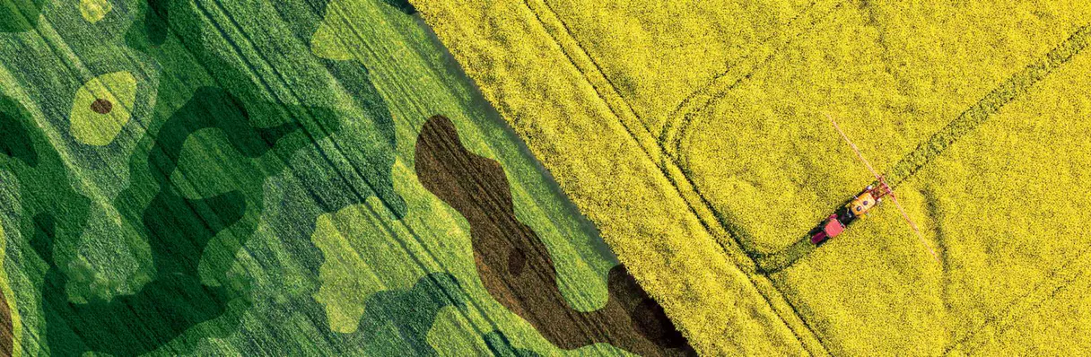
Geopard Agriculture MCP. Check field health, run analytics, and map crop data.
 Gemini
 Works with every AI agent you already use
…and any MCP-compatible client
Just plug in your AI agents and start using Vinkius.
Geopard Agriculture MCP Server gives your AI agent real-time access to field data. List registered fields, get detailed analytics like NDVI and soil moisture, and monitor current crop health layers.
It acts like a dedicated agronomist, letting you check field status and plan resource allocation from a single conversation.
What your AI agents can do
Get agri fields
Lists every registered agricultural field managed by the system.
Get crop health data
Retrieves the current crop health indicators for a specified field.
Get field analytics
Gets detailed analytics, including NDVI and soil moisture, for a specific field.
The agent retrieves a list of every registered agricultural field, including its specific area size.
The agent pulls current crop health layers to identify any signs of stress or optimal growth across a field.
The agent fetches detailed analytics, like NDVI scores and soil moisture percentages, for a specific field.
Ask AI about this MCP
Supported MCP Clients
Gemini Waiting for input…
Geopard Agriculture MCP Server: 3 Tools for Field Data Analysis
Analyze field boundaries, check crop health layers, and get deep metrics like NDVI and soil moisture for precise agricultural planning.
019d843fget agri fields
Lists every registered agricultural field managed by the system.
019d843fget crop health data
Retrieves the current crop health indicators for a specified field.
019d843fget field analytics
Gets detailed analytics, including NDVI and soil moisture, for a specific field.
Choose How to Get Started
Build a custom MCP for your own tools, or connect a ready-made integration from our catalog.
Build Your Own
Turn any API into an MCP. Import a spec, define Agent Skills, or deploy with MCPFusion.
- Import from OpenAPI, Swagger, or YAML specs
- Create Agent Skills with progressive disclosure
- Deploy to edge with MCPFusion framework
- Built in DLP, auth, and compliance on every call
- Real time usage dashboard and cost metering
- Publish to catalog or keep private
Make Your AI Do More
Start with Geopard Agriculture, then connect any of our 4,700+ other servers whenever your AI needs more. One click, no limits.
- Use this MCP plus 4,700+ others, all in one place
- Add new capabilities to your AI anytime you want
- Every connection is secured and compliant automatically
- Track usage and costs across all your servers
- Works with Claude, ChatGPT, Cursor, and more
- New servers added to the catalog every week
What you can do with this MCP connector
This MCP Server gives your AI agent real-time access to field data. You can use it to list every registered field and get detailed analytics, like NDVI and soil moisture, while monitoring current crop health layers. It acts like having a dedicated agronomist right there with you, letting you check field status and plan resource allocation all in one go.
Using get_agri_fields, your agent pulls a list of every managed agricultural field, including its specific area size.
get_crop_health_data pulls current crop health layers, helping you spot any signs of stress or optimal growth across a field.
get_field_analytics fetches detailed analytics for a specific field, providing metrics like NDVI scores and soil moisture percentages.
How Geopard Agriculture MCP Works
- 1 Subscribe to the Geopard server and provide your API key.
- 2 Your AI client sends a natural language request (e.g., 'What's the soil moisture in the Corn Sector?').
- 3 The agent invokes the relevant tool (
get_field_analytics) and returns the data directly to your client for analysis.
The bottom line is that your agent talks to the server, which runs the necessary data checks and gives you the numbers.
Who Is Geopard Agriculture MCP For?
Farmers and Farm Managers who need to move beyond general satellite views. If you're tired of guessing where the problem area is, this is for you. It's also perfect for Agronomists who need to pull reliable, technical data for reports, or Ag-Tech developers building field monitoring tools.
Uses the agent to check field conditions and crop health in real-time, making immediate decisions on water or fertilizer application.
Pulls precise technical data—like NDVI scores and historical performance summaries—to support client reports and optimize resource allocation.
Integrates precise, structured agricultural data into their own AI applications and decision support systems.
What Changes When You Connect
- Identify stress zones immediately. The agent uses
get_crop_health_datato pinpoint specific areas with poor crop health layers, so you don't waste inputs on healthy sections. - Get hyper-localized data. Instead of regional averages,
get_field_analyticsdelivers specific metrics—like NDVI and soil moisture—for any coordinate you point to. - Manage your whole farm easily. Use
get_agri_fieldsto pull a full list of all managed parcels and their exact acreage, keeping your inventory straight. - Improve resource spending. By fetching historical field performance data, you can audit past seasons and allocate fertilizer or water more accurately next time.
- Support deep research. Agronomists can pull reliable technical data through the agent to build reports or test out sustainable farming trends.
- Directly compare data points. You can run multiple checks (fields, health, analytics) in one session, giving you a single, comprehensive view of the farm's status.
Real-World Use Cases
Diagnosing localized nutrient issues
A farm manager notices the yield is uneven. They ask their agent to run get_field_analytics on the suspected zone. The agent returns a low NDVI score and low soil moisture, telling the manager exactly where and why the inputs are failing.
Planning seasonal irrigation
A farm manager needs to know which fields to water first. They use get_agri_fields to list all parcels, then run get_crop_health_data for each one, prioritizing the fields showing 'Water Stress' layers.
Auditing past seasons' efficiency
An agronomist needs to write a report on resource waste. They use get_field_analytics to compare the soil moisture data from this year against last year's numbers, proving where the resource gaps were.
Quickly checking field boundaries
A new employee needs to know how many plots are on the property. They simply ask the agent to run get_agri_fields, getting an instant list of all registered parcels and their sizes.
The Tradeoffs
Using general satellite imagery
Relying solely on broad-scale images that show a field is 'low' in health. This tells you nothing about the specific corner or nutrient issue causing the problem.
→
Instead, run get_field_analytics on specific coordinates to get the exact NDVI and soil moisture readings. This moves you from a general problem to an actionable, precise fix.
Checking tools individually
Running get_agri_fields first, then get_crop_health_data, and then get_field_analytics in three separate calls. This slows down the process and requires you to manually cross-reference three different screens.
→ Use your AI client to chain the calls. Ask the agent to 'Check the health and analytics for the North Vineyard.' The agent coordinates the necessary tools and delivers one unified answer.
Ignoring field boundaries
Applying fertilizer to a large zone based on an average, even if half the zone is pasture. You waste money and miss the target area.
→
Always start by listing the exact boundaries using get_agri_fields. This guarantees the agent only pulls data for the correct, registered parcel before running health or analytics.
When It Fits, When It Doesn't
Use this if you need hyper-localized, quantitative data for decision-making. You need to know why the yield is low and where the stress is located—not just that the yield is low.
Don't use this if you just need a general overview or high-level mapping. If your goal is simply to compare general region health against a regional standard, a standard mapping service might suffice. But if you need to know the soil moisture level at a specific GPS point or the exact NDVI score for a micro-zone, this is the tool. It's about precision, not panorama.
Independent Platform Disclaimer: Vinkius is an independent platform and is not affiliated with, endorsed by, sponsored by, verified by, or otherwise authorized by Geopard. All third-party trademarks, logos, and brand names are the property of their respective owners. Their use on this website is strictly for informational purposes to identify service compatibility and interoperability.
VINKIUS INFRASTRUCTURE
Cloud Hosted
Managed infra
V8 Isolated
Sandboxed per request
Zero-Trust Proxy
No stored credentials
DLP Enforced
Policy on every call
GDPR Compliant
EU data residency
Token Compression
~60% cost reduction
Works with Claude, ChatGPT, Cursor, and more
The Model Context Protocol standardizes how applications expose capabilities to LLMs. Instead of operating in isolation, your AI gains direct access to external platforms, live data, and real-world actions through secure, standardized connections.
This server provides 3 capabilities that interface natively with Claude, ChatGPT, Cursor, and any MCP client. No middleware. No custom integration required.
Available Capabilities
Doing field checks manually means jumping between maps, spreadsheets, and sensor dashboards.
Right now, if you need a full picture of a field, you open the GIS map. You find the field ID. Then you copy that ID into the soil moisture dashboard. After that, you open the crop health report and manually match the date and the coordinates. It's a frustrating, slow process of copy-pasting and cross-referencing tabs.
With the Geopard Agriculture MCP Server, you just tell your agent the field name. It handles the ID lookups, pulls the crop health layers using `get_crop_health_data`, and feeds the specific analytics into one answer. You get the answer without leaving the chat.
get_field_analytics: Get NDVI and soil moisture data instantly.
Before, figuring out the specific nutrient level for a micro-zone meant running multiple, separate analyses in specialized software. You'd get one number for NDVI, and another number for moisture, and you'd have to mentally correlate them to draw a conclusion.
Now, you ask for the analytics, and the agent runs `get_field_analytics`. It combines the vegetation index, the moisture reading, and any other key data points into a single, readable output. It's one step, one conclusion.
Common Questions About Geopard Agriculture MCP
How do I list all my fields using get_agri_fields? +
You ask your agent to list all fields. It runs get_agri_fields and immediately returns a list of every registered parcel, including the name and the size of the area.
What data can get_field_analytics retrieve for a field? +
It retrieves detailed metrics, including the current NDVI score and the soil moisture percentage, for the specific field you name. This data is critical for planning resource application.
Can get_crop_health_data find stress zones? +
Yes. This tool accesses current crop health layers and points out potential stress zones, like nitrogen deficiencies or water stress, helping you focus your efforts.
Do I need an API key to use the Geopard Agriculture MCP Server? +
Yes. You must subscribe to the server and provide your unique Geopard API Key. This allows your AI client to authenticate and access your private field data.
What do I need to do before I can use the `get_field_analytics` tool? +
You must subscribe to the Geopard Agriculture MCP Server and provide your Geopard API Key. After setup, your AI client accesses real-time data, allowing you to pull analytics for any specific field ID.
How does the `get_crop_health_data` tool identify stress zones? +
The tool accesses current crop health layers and reports specific indicators. For instance, it flags 'Water Stress' or 'Nitrogen Level' issues, giving you the exact layer and location of concern.
Does `get_agri_fields` provide the acreage for each listed field? +
Yes, the get_agri_fields tool returns a complete list of managed fields, and each entry includes its specific area data, measured in hectares (ha).
If I run `get_field_analytics` for a field, what data does it include? +
The get_field_analytics tool returns high-precision data points, including the mean NDVI and current soil moisture percentage, for the specified field coordinates.
How can I see the NDVI index for my field? +
Use the get_field_analytics tool with your specific Field ID. The response will include the Mean NDVI value, which indicates the vegetation health and biomass.
Does this work for any location? +
The server retrieves data for fields already registered and mapped in your Geopard account. Ensure your parcels are setup in the Geopard dashboard first.
Can I check soil moisture levels? +
Yes. The get_field_analytics tool includes soil moisture estimates among other precision indicators retrieved from the satellite data layers.
Use it with your favorite AI tools
Connect this server to Cursor, Claude, VS Code, and more.
More in this category

Symbl.ai
Extract conversation intelligence from audio, video, and text — get summaries, action items, and topics directly from any AI agent.

TextRazor
Advanced Natural Language Processing (NLP) to extract entities, topics, and relations from text or URLs.

LicenseCheck API
Search software licenses — audit permissions and conditions via AI.
You might also like

Pixabay
Search and retrieve royalty-free stock images, vectors, illustrations, and videos via AI directly from Pixabay.

Plecto
Automate KPI dashboards and data tracking via Plecto — manage registrations, dashboards, and teams directly from any AI agent.

Twilio SendGrid
Equip your AI agent with capabilities to natively dispatch HTML emails, prune suppression bounce lists, and manage marketing contacts via the SendGrid API.