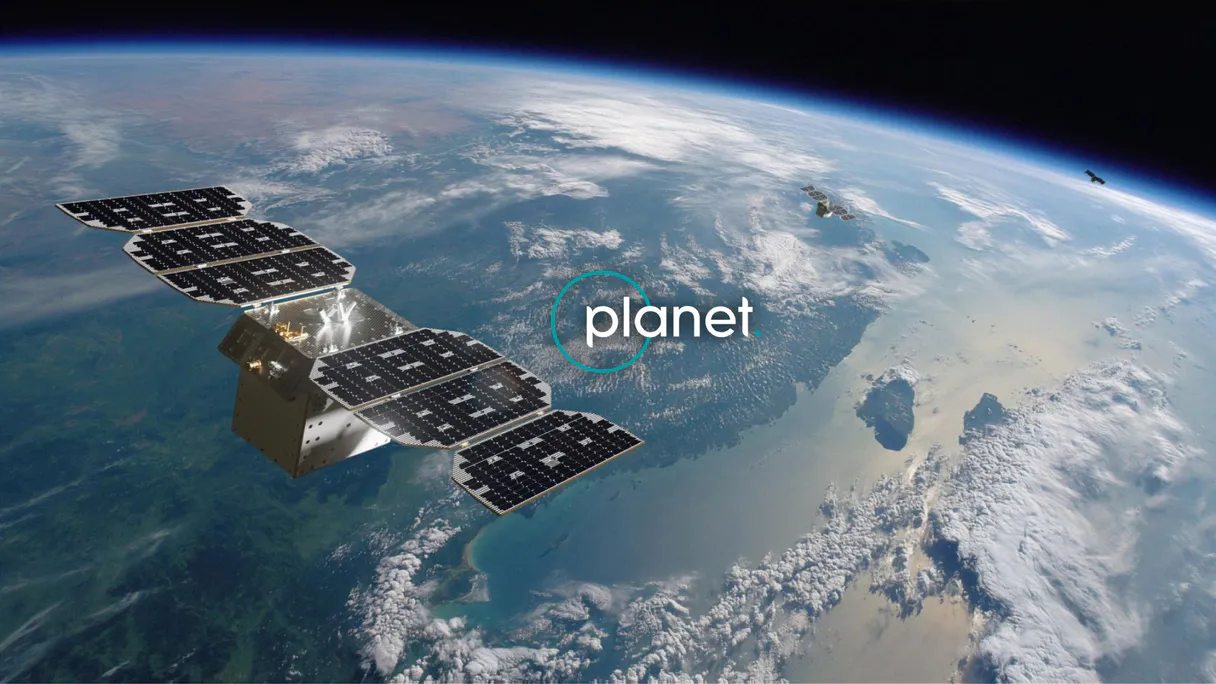
Planet Labs MCP. Run complex satellite searches by area and time.
 Gemini
 Works with every AI agent you already use
…and any MCP-compatible client
Just plug in your AI agents and start using Vinkius.
Planet Labs MCP Server gives your AI client full control over daily satellite imagery search, discovery, and automated delivery. You can run complex queries across multiple sources—like PlanetScope (3-5m), SkySat (sub-meter), RapidEye (5m), Landsat (30m), and Sentinel-2 (10m).
Use tools like `quick_search` to filter by cloud cover or set up recurring monitoring with `create_saved_search`. It’s built for environmental scientists, disaster response teams, and GIS pros who need reliable geo-spatial data on demand.
What your AI agents can do
Create saved search
Saves complex search criteria (geometry, date filters) so you can run the same query repeatedly without re-entering parameters.
Create subscription
Sets up automated data delivery feeds that constantly check for and deliver new imagery matching your specified rules.
Get cloud coverage
Returns the clear percentage and cloud status of a specific image item, helping you judge its quality before use.
You pass geometry (GeoJSON), a date range, and quality metrics like cloud cover to quick_search to pull immediate search results.
The create_subscription tool automatically generates a persistent delivery stream of imagery matching specific criteria (e.g., daily, cloud-free).
You run get_cloud_coverage on an item ID to get the percentage of clear area before committing to a download.
Using get_item_assets, you list all downloadable file types (visual, analytic, etc.) for a specific image item.
You use create_saved_search to define and save complex search parameters for later automated execution via get_search_results.
Ask AI about this MCP
Supported MCP Clients
Gemini Waiting for input…
Planet Labs: 12 Tools for Geospatial Data Mastery
This suite of twelve tools allows your AI agent to perform every step of the geospatial workflow—from catalog discovery and quality checking to automated, continuous data delivery.
019d75f6create saved search
Saves complex search criteria (geometry, date filters) so you can run the same query repeatedly without re-entering parameters.
019d75f6create subscription
Sets up automated data delivery feeds that constantly check for and deliver new imagery matching your specified rules.
019d75f6get cloud coverage
Returns the clear percentage and cloud status of a specific image item, helping you judge its quality before use.
019d75f6get item assets
Lists all available data formats (like visual PNGs or analytic GeoTIFFs) for an image item so you know what to download.
019d75f6get item details
Pulls comprehensive metadata on a single image, including acquisition time and specific conditions under which it was taken.
019d75f6get search results
Executes a saved search ID or runs an ad-hoc query to retrieve a paginated list of matching imagery items.
019d75f6get search statistics
Generates histograms showing how frequently images are available for a given area and time period, useful for planning.
019d75f6list asset types
Returns the full list of data products (visual, analytic, UDM) that Planet Labs supports across all imagery types.
019d75f6list item types
Provides a catalog listing every available satellite source, detailing its resolution and supported assets (e.g., SkySat or Sentinel-2).
019d75f6list saved searches
Retrieves the names and IDs of all monitoring searches you've previously configured in your account.
019d75f6list subscriptions
Shows a list of all active or inactive automated delivery subscriptions you have set up.
019d75f6quick search
Performs an immediate search for imagery using geometry, date ranges, and cloud filters to find results right now.
Choose How to Get Started
Build a custom MCP for your own tools, or connect a ready-made integration from our catalog.
Build Your Own
Turn any API into an MCP. Import a spec, define Agent Skills, or deploy with MCPFusion.
- Import from OpenAPI, Swagger, or YAML specs
- Create Agent Skills with progressive disclosure
- Deploy to edge with MCPFusion framework
- Built in DLP, auth, and compliance on every call
- Real time usage dashboard and cost metering
- Publish to catalog or keep private
Make Your AI Do More
Start with Planet Labs, then connect any of our 4,700+ other servers whenever your AI needs more. One click, no limits.
- Use this MCP plus 4,700+ others, all in one place
- Add new capabilities to your AI anytime you want
- Every connection is secured and compliant automatically
- Track usage and costs across all your servers
- Works with Claude, ChatGPT, Cursor, and more
- New servers added to the catalog every week
What you can do with this MCP connector
When you connect your AI client to this server, you get full control over finding, monitoring, and managing satellite imagery. You don't need a data science degree to run complex geo-spatial queries; your agent handles the heavy lifting.
Finding Imagery Now:
You can execute an immediate search for images using quick_search. Just pass it the geometry you care about (GeoJSON), a date range, and quality filters—like setting minimum cloud coverage. This pulls up a paginated list of results right away.
If you know what you're looking for but don't want to re-enter all those parameters every time, use create_saved_search. This lets you define complex search criteria—geometry and date filters—and save them under an ID. Later, you run that saved query using get_search_results without touching the original inputs.
For monitoring projects that run constantly, set up automated feeds with create_subscription. You specify rules (like 'daily' or 'cloud-free') and the system generates a persistent delivery stream of imagery matching those criteria. To see what monitoring you already have active or inactive, check list_subscriptions, and if you need to reference saved parameters, run list_saved_searches.
Assessing Quality and Data:
Before you download anything, you gotta know if the image is good enough. Run get_cloud_coverage on any item ID; it returns a clear percentage alongside the cloud status. This tells you exactly how much usable area you're getting. Once you have an item, use get_item_details to pull all the metadata—the acquisition time and the specific conditions under which Planet captured the image.
To know what files you can actually download, run get_item_assets. This lists every available data format for that single image, like visual PNGs or analytic GeoTIFFs. You also need to understand the whole menu of assets supported by the platform; list_asset_types gives you a full catalog of products, including visual, analytic, and UDM formats.
Planning and Cataloging:
You can plan out your data needs using get_search_statistics. This generates histograms showing how often imagery is available for a specific area over time—useful for figuring out if an area gets covered regularly or if you're going to have gaps. To understand the full scope of sources, use list_item_types to see every satellite source available (like SkySat or Sentinel-2), getting details on their resolution and what assets they support.
Finally, list_asset_types gives you a definitive list of all data products across the board.
This whole setup means your agent can handle everything from running an initial search to setting up automated alerts and checking every file type before you commit to a download.
How Planet Labs MCP Works
- 1 First, subscribe to the server and provide your Planet API key. This authorizes access.
- 2 Next, tell your AI client what you need—for instance, 'Search for cloud-free images over my farm.' The agent selects the appropriate tool (e.g.,
quick_search). - 3 Finally, the server executes the query against the live Planet catalog and returns structured metadata results that your system can process.
The bottom line is: it lets your AI client act as a dedicated satellite imagery analyst, handling everything from initial search to setting up automated data streams.
Who Is Planet Labs MCP For?
Anyone dealing with massive amounts of time-sensitive geospatial data. This is for the environmental scientist who needs to track deforestation over months; the disaster response coordinator needing pre- and post-event imagery immediately; or the agricultural analyst tracking crop health across vast fields.
Uses list_item_types to compare Sentinel-2 vs. Landsat resolutions, then uses get_search_statistics to model wetland changes over a decade.
Runs create_saved_search for specific polygons and asset types (like surface reflectance) needed for mapping projects. They rely heavily on structured data output.
Sets up a subscription via create_subscription to receive daily, cloud-free imagery over crop fields automatically for NDVI analysis.
What Changes When You Connect
- Instant Image Discovery: Don't manually browse catalogs. Use
quick_searchto find images matching specific geometry, date ranges, or cloud cover percentages in one command. - Automated Monitoring: Set it and forget it. Use
create_subscriptionto guarantee that new imagery (like daily PSScene shots) is automatically delivered without manual intervention. - Data Quality Assurance: Stop downloading useless photos.
get_cloud_coveragetells you the clear area percentage first, letting your system filter out cloudy junk before processing. - Deep Catalog Understanding: The difference between asset types matters. Use
list_asset_typesandlist_item_typesto know exactly which data product (e.g., true-color PNG vs. surface reflectance GeoTIFF) you need for analysis. - Workflow Persistence: Defining a search once is enough.
create_saved_searchlets you save complex queries, then run them later usingget_search_resultswithout repeating the filter logic.
Real-World Use Cases
Assessing Post-Disaster Damage
A coordinator needs to check a flood zone. They use quick_search with the disaster polygon and date range, filtering out any images below 80% cloud coverage. They then pass the resulting item IDs to get_item_assets to download high-resolution analytic data for damage mapping.
Setting up Long-Term Crop Health Checks
An agronomist doesn't want to check manually. They use create_subscription to set up a daily feed over their farm boundary, demanding PSScene images with less than 10% cloud cover. The system handles the continuous data flow.
Comparing Satellite Sources
A researcher needs to know which satellite type is best for their region. They call list_item_types and examine the output, comparing SkySat's sub-meter detail against Landsat's 30m coverage before deciding on a search strategy.
Planning Data Collection Cycles
A climate scientist needs to prove historical monitoring gaps. They run get_search_statistics for their area and date range, generating a histogram that shows exactly how many images were available per month, proving data scarcity or abundance.
The Tradeoffs
Running the same query manually every time
Manually typing out the polygon coordinates and 30-day date range into a search prompt every week. This is slow, tedious, and prone to copy/paste errors.
→
Use create_saved_search first with your specific parameters. Then, simply call get_search_results using that saved ID each week. It's faster and guaranteed to be consistent.
Assuming all images are ready for download
Attempting to run a workflow that immediately downloads an image without checking its quality or available formats, leading to failed API calls.
→
Always check the item first. Run get_cloud_coverage to ensure usability, then call get_item_assets to confirm the correct data format (e.g., GeoTIFF vs. PNG) is available before writing download code.
Building a custom delivery system
Writing complex Python scripts just to check for new images and upload them to S3 bucket, managing credentials and retries yourself.
→
Use create_subscription. This tool handles the entire infrastructure of continuous monitoring and delivery (to cloud storage or webhooks) so your system stays clean.
When It Fits, When It Doesn't
Use this server if your core task involves locating, filtering, or streaming geo-spatial data from multiple satellite sources. The key distinction is between discovery and persistence:
* Immediate Need: If you need results right now for a specific area, use quick_search. It's for ad-hoc checks.
* Repeatable Monitoring: If the query repeats (e.g., 'every week over this farm'), don't keep using quick_search. You must use create_saved_search first, and then execute it with get_search_results. This is how you build reliable monitoring pipelines.
* Continuous Stream: If the need is to receive data as soon as it becomes available (e.g., 'daily feeds'), only create_subscription works. It's the dedicated tool for keeping your system constantly fed with fresh assets.
Don’t try to use an asset listing function (list_asset_types) when you need actual search results; those tools are purely for catalog understanding.
Independent Platform Disclaimer: Vinkius is an independent platform and is not affiliated with, endorsed by, sponsored by, verified by, or otherwise authorized by Planet Labs. All third-party trademarks, logos, and brand names are the property of their respective owners. Their use on this website is strictly for informational purposes to identify service compatibility and interoperability.
VINKIUS INFRASTRUCTURE
Cloud Hosted
Managed infra
V8 Isolated
Sandboxed per request
Zero-Trust Proxy
No stored credentials
DLP Enforced
Policy on every call
GDPR Compliant
EU data residency
Token Compression
~60% cost reduction
Works with Claude, ChatGPT, Cursor, and more
The Model Context Protocol standardizes how applications expose capabilities to LLMs. Instead of operating in isolation, your AI gains direct access to external platforms, live data, and real-world actions through secure, standardized connections.
This server provides 12 capabilities that interface natively with Claude, ChatGPT, Cursor, and any MCP client. No middleware. No custom integration required.
Available Capabilities
Sourcing satellite data used to take hours of manual API calls and spreadsheet work.
Before this server, finding usable imagery was a painful process. You'd have to log into the catalog, manually enter coordinates for every test area, run the search, check the date filters, and then cross-reference cloud cover percentage against your project requirements. If you missed one filter or had to adjust the polygon slightly, you started over.
With this MCP server, your AI client handles all that complexity. You simply state: 'Find me images of my field from last month.' The agent instantly calls `quick_search` and filters by date, geometry, *and* cloud cover in one go. You get structured results immediately.
Using the Planet Labs API with `create_subscription` gets you continuous data feeds.
Manually setting up automated monitoring meant managing webhooks, polling APIs constantly, and writing complex background jobs just to check if a new image was ready. If your script failed or the cloud service went down, your entire monitoring workflow stopped until you fixed it.
Now, `create_subscription` handles that infrastructure complexity. You define the criteria once—say, 'cloud-free PSScene images.' The server manages the continuous check and delivery to your specified storage location, keeping your pipeline running automatically.
Common Questions About Planet Labs MCP
How do I find cloud-free imagery using quick_search? +
quick_search supports filtering by cloud cover. You must include the filter object specifying a range (e.g., 0-10%) for 'cloud_cover' when calling this tool.
What is the difference between list_item_types and quick_search? +
list_item_types just shows you what sources are available (Sentinel, SkySat). quick_search actually runs a live query against those sources to find real imagery items for your area.
How do I set up automated monitoring with create_subscription? +
You call create_subscription and provide the geometry, date filters, and the delivery destination. It then manages continuous checks and automatically sends new data when it becomes available.
Should I use get_search_results or quick_search? +
Use quick_search for one-off searches. Use get_search_results after you've defined a search using create_saved_search; it executes the saved definition.
How does `get_item_assets` help me choose the right data product for analysis? +
It lists every available file type and its download URL. You need this to differentiate between visual assets (for viewing, like PNG) and analytic assets (GeoTIFFs used for calculations like NDVI). It ensures you grab exactly what your GIS software requires.
What's the workflow difference between `create_saved_search` and just running a quick search? +
You use create_saved_search to define a reusable template—it saves your specific filters (e.g., 'cloud-free, 30 days'). Then, you run that saved ID later using get_search_results. This keeps complex monitoring configurations organized and repeatable.
Before downloading images, how can I check the quality using `get_cloud_coverage`? +
This tool gives you a clear percentage of usable area and cloud cover. It's essential for filtering out unusable data before you waste time or credits on downloads. If the coverage is low, your AI client knows to ask for better parameters.
If I'm planning a large project, how can `get_search_statistics` help me gauge temporal coverage? +
It generates histograms showing imagery availability over time within an area. Instead of just checking if an image exists, this tool shows you patterns—like knowing exactly which month has the best satellite overlap for your site.
Can my AI search for cloud-free satellite imagery over my farm from last month? +
Yes! Use the quick_search tool with your farm boundary as GeoJSON geometry, date range for last month, item_types=PSScene, and max_cloud_cover=10 (for 10% or less cloud cover). The search returns all available imagery matching your criteria with acquisition dates, cloud cover percentages, and download URLs for visual and analytic assets. For ongoing monitoring, create a saved search with create_saved_search and execute it regularly with get_search_results.
What is the difference between PSScene, SkySat, and RapidEye imagery? +
PSScene (PlanetScope) provides daily global coverage at 3-5m resolution with 200+ satellites, ideal for broad-area monitoring and time-series analysis. SkySat offers sub-meter resolution (0.5-0.9m) with video capability, perfect for detailed inspection of specific sites. RapidEye provides 5m resolution with a 5-band sensor (including red-edge) and a deep historical archive dating back to 2009. Use list_item_types to see all available imagery types and their supported asset types.
How do I set up automated daily imagery delivery for my area of interest? +
Use the create_subscription tool with your area geometry, item types (e.g., PSScene), and cloud cover filter. You can specify delivery to AWS S3, Google Cloud Storage, Azure Blob, or webhook endpoints. The subscription will continuously deliver new imagery matching your criteria as it becomes available. To manage existing subscriptions, use list_subscriptions to review and monitor active deliveries.
Use it with your favorite AI tools
Connect this server to Cursor, Claude, VS Code, and more.
More in this category

arXiv
Search 2.5M+ scientific preprints across physics, computer science, mathematics, biology, economics, and more — with full abstracts, author lists, and direct PDF download links.

WHO GHO
Access 2,200+ health indicators from 194 countries — life expectancy, disease prevalence, mortality rates, immunization coverage, and environmental health data from the World Health Organization.

EIA Natural Gas — Gas Market Intelligence
Natural gas market data: Henry Hub spot and futures prices, underground storage levels (the weekly report that moves markets), LNG imports/exports, production by state, pipeline flows, and consumption by sector.
You might also like
Cognita (RAG Framework)
Manage modular RAG via Cognita — list collections, ingest data sources, and perform AI-driven Q&A directly from any AI agent.

Quotable API
Access thousands of quotes — audit authors and tags via AI.

Google Ads
Equip your AI agent with direct access to Google Ads — manage search, display, and shopping campaigns, track conversions, and optimize ad spend without opening the Google Ads console.