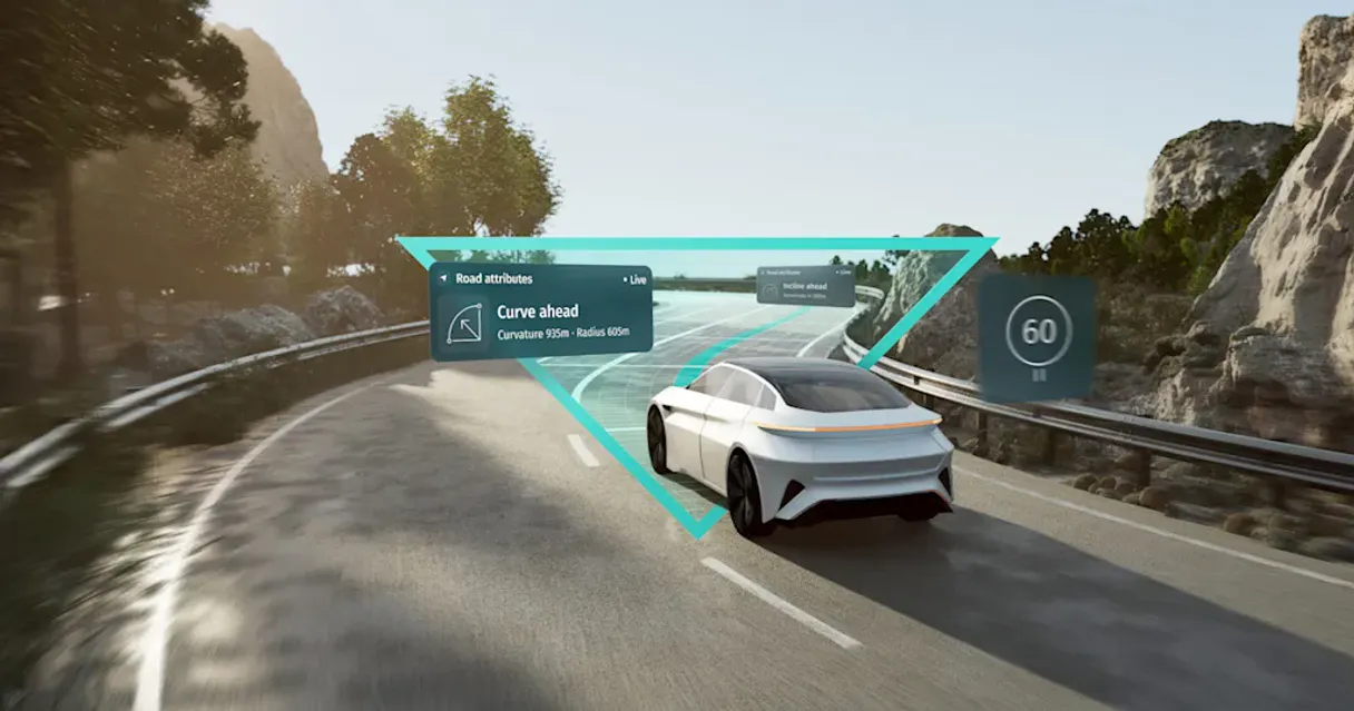
HERE (Location & Maps) MCP. Analyze routes and track traffic using natural conversation.
HERE Technologies provides robust location intelligence for your AI agent. You can convert addresses to precise coordinates, find the best routes considering current traffic, model reachability polygons, and fetch live weather forecasts anywhere on Earth.
Give Claude and any AI agent real-world access
The tool converts human-readable addresses into exact coordinates and vice versa.
It calculates the best paths for vehicles, pedestrians, or trucks, factoring in distance and time constraints.
You can visualize polygons that show exactly how far a person or vehicle can travel within a set time or mileage limit from a starting point.
The system tracks current congestion and traffic speeds across specific areas to optimize delivery timing.
It fetches up-to-date weather observations and forecasts for any global location.
Ask an AI about this
Waiting for input…
What AI agents can do with HERE (Location & Maps) with 10 Tools
These tools allow you to perform every kind of spatial analysis imaginable—from finding addresses to calculating complex travel matrices.
Make your AI actually useful.
Add this MCP to Claude, Cursor, or Windsurf and your AI stops guessing. It gets real tools to look things up, take action, and handle the stuff you keep doing by hand.
Start using HERE (Location & Maps) MCPAutosuggest Query
Find precise location suggestions by querying active address arrays.
Calculate V8 Isoline
Determine the boundaries of where a person or vehicle can travel within specified...
Calculate Routing Matrix
Generate complex data payloads showing travel times between multiple, connected...
Calculate V8 Route
Inspect detailed traffic patterns to calculate the most efficient route between two...
Discover Places
Search for and retrieve specific categories of points of interest (POI) in an area.
Forward Geocode
Convert a human-readable address into precise, bounded coordinates within a search region.
Get Traffic Flow
Retrieve current traffic data and congestion patterns for any defined geographical area.
Get Weather Observation
Fetch explicit, structured reports detailing the active meteorological conditions...
Lookup Place Id
Get a unique identifier for specific locations to use in deeper point-of-interest...
Reverse Geocode
Convert coordinates back into meaningful, readable street addresses or boundaries.
Security and governance baked right in.
Pick your AI client below to get set up. Just create a Vinkius account, subscribe, and you're instantly up and running. We handle the entire backend infrastructure, delivering out-of-the-box support for HTTPS Streamable, SSE, and OAuth2—zero messy routing required.
Claude AI
Open Claude Settings
Go to claude.ai, click your profile icon, then navigate to Customize → Connectors.
Add Custom Connector
Click the "+" button and select Add custom connector. Paste your Vinkius endpoint URL:
https://edge.vinkius.com/[YOUR_TOKEN_HERE]/mcp
Replace [YOUR_TOKEN_HERE] with your token
from cloud.vinkius.com. For OAuth-protected servers, expand
Advanced settings to add credentials.
Start a conversation
Open a new chat. The HERE (Location & Maps) integration is available immediately — no restart needed.
Choose How to Get Started
Build a custom MCP for your own tools, or connect a ready-made integration from our catalog.
Build Your Own
Turn any API into an MCP. Import a spec, define Agent Skills, or deploy with MCPFusion.
- Import from OpenAPI, Swagger, or YAML specs
- Create Agent Skills with progressive disclosure
- Deploy to edge with MCPFusion framework
- Built in DLP, auth, and compliance on each call
- Real time usage dashboard and cost metering
- Publish to catalog or keep private
Make Your AI Do More
Start with HERE (Location & Maps), then connect any of our 5,200+ other servers whenever your AI needs more. One click, no limits.
- Use this MCP plus 5,200+ others, all in one place
- Add new capabilities to your AI anytime you want
- Connections are secured and governed automatically
- Track usage and costs across all your servers
- Works with Claude, ChatGPT, Cursor, and more
- New servers added to the catalog weekly
Independent Platform Disclaimer: Vinkius is an independent platform and is not affiliated with, endorsed by, sponsored by, verified by, or otherwise authorized by HERE Technologies. All third-party trademarks, logos, and brand names are the property of their respective owners. Their use on this website is strictly for informational purposes to identify service compatibility and interoperability.
VINKIUS CLOUD
Cloud Hosted
Managed infra
V8 Isolated
Sandboxed per request
Zero-Trust Proxy
No stored credentials
DLP Enforced
Policy on each call
GDPR Compliant
EU data residency
Token Compression
~60% cost reduction
The headache of disconnected location data
Right now, if you're managing a fleet, you have to jump between a spreadsheet for routes, an external mapping service for current traffic, and another tool just to check the weather. You copy coordinates from one tab to another, manually calculate matrices in a third program, and then finally paste the result into your report. It’s a horrible workflow that wastes hours every week.
With this MCP, you talk to your agent once. 'What's our delivery plan for tomorrow?' The agent handles the entire chain: it finds the best route using `calculate_v8_route`, checks if rain is predicted via `get_weather_observation`, and calculates the total time considering current traffic flow—all in one go.
Get instant, actionable insights with HERE (Location & Maps)
You don't have to manually run multiple queries. You don't need to worry about which data source is the most current or if the coordinates are in the right format. The agent manages the complexity behind the scenes.
The result is a single, cohesive answer delivered conversationally. Your team moves from spending time stitching together data points to actually making decisions based on accurate, real-time location intelligence.
What HERE (Location & Maps) MCP does for your AI
This MCP connects complex global mapping data directly into your AI client, letting you perform advanced spatial analytics using natural conversation. Instead of jumping through multiple GIS dashboards or writing complicated code, you simply ask your agent for the information you need—whether it's figuring out the optimal delivery route considering real-time congestion, or determining how far a worker can travel in 30 minutes from a specific warehouse location.
It handles geocoding addresses to coordinates and finding nearby points of interest automatically. If you build applications using this MCP through Vinkius, your agent gains full control over everything from traffic flow monitoring to fetching detailed weather reports for any spot on the map.
019d75af-d45a-70e6-b09c-0cb685ad4202 How to set up HERE (Location & Maps) MCP
The bottom line is you stop treating location analysis as a separate piece of software and start using it conversationally within your agent.
Subscribe to this MCP and provide your unique HERE API Key.
Connect the key to your AI client, giving your agent access to spatial data tools.
Ask your agent a question like 'What's the fastest route from Point A to Point B with current traffic?' and get an immediate answer.
Who uses HERE (Location & Maps) MCP
This MCP is essential for logistics managers who spend hours planning delivery routes, urban planners studying city accessibility, or developers building context-aware applications that need real-world mapping data.
You use the tool to calculate optimal multi-stop routes and generate travel time matrices for your entire fleet, saving fuel and hours of manual planning.
You ask the agent to analyze complex reachability polygons or perform geocoding searches without needing a dedicated desktop GIS program.
You integrate real-time traffic flow and weather observations into your AI agent's context, making your application smarter and more reactive to the environment.
Benefits of connecting HERE (Location & Maps) MCP
Instead of manually checking multiple mapping services, your agent handles it all. You ask for the optimal route from Point A to Point B, factoring in current congestion via calculate_v8_route, and get a single, accurate answer.
Planning supply chains? The tool's ability to generate complex distance matrices using calculate_routing_matrix lets you model travel times between dozens of stops instantly. It’s perfect for fleet management.
Need to know if a new store location is accessible? Use the calculate_v8_isoline function to visualize exactly how far and how fast people can get there, which is better than just looking at a pin on a map.
Developers now have instant access to live environmental data. You can fetch current weather observations with get_weather_observation or monitor real-time traffic flow using get_traffic_flow, making your applications hyper-contextual.
The process of converting addresses is simple. Use forward_geocode to get coordinates, and then use reverse_geocode when you only have the numbers, giving you full location control.
HERE (Location & Maps) MCP use cases
Optimizing a multi-city delivery schedule
A logistics manager needs the fastest route for 15 stops across three counties. Instead of using spreadsheet software and manual calculations, they ask their agent to calculate the routing matrix. The system returns the most efficient sequence and total time immediately.
Assessing emergency response zones
During a simulated disaster, an urban planner needs to know how far first responders can travel in 20 minutes from a main hub. They ask their agent to generate an isoline polygon using calculate_v8_isoline, which immediately defines the safe operational zone.
Building a context-aware field service app
A developer builds an application that tells technicians if a job is possible. The agent first checks the weather using get_weather_observation and then uses this MCP to check traffic flow, ensuring the technician doesn't leave until conditions are right.
Determining nearest points of interest
A user is at a specific coordinate and needs to find nearby gas stations or hospitals. They ask their agent to discover places using discover_places rather than manually searching through multiple map views.
HERE (Location & Maps) MCP tradeoffs
What to watch out for, and the recommended way to handle each one.
Assuming simple point-to-point travel
A user asks, 'What is the route from X to Y?' and gets a basic driving line without considering current road closures or traffic.
To account for real-world conditions, you must use calculate_v8_route or get_traffic_flow. These tools process live data to give you a path that actually works right now.
Only using addresses and no coordinates
The user tries to analyze flow by typing out three street names, which is too vague for any serious mapping tool.
Always start by converting the address into precise data points. Use forward_geocode first; it provides the exact bounded routing space you need.
Ignoring travel time limits
The user thinks they can cover a huge area in an hour, but doesn't know if that area is actually reachable by car in that timeframe.
Use calculate_v8_isoline to set boundaries. This tool tells you the realistic reach based on time or distance constraints, preventing bad logistical planning.
When to use HERE (Location & Maps) MCP
You should use this MCP if your problem involves physical space, movement, or time—anything that needs a map. If you need to know how far something is, what the best way to get there is, or if current weather/traffic will impact the journey, this is what you need. Don't use it if your task is purely data transformation (like simple CSV parsing) or if you just need to search for text strings; those are better handled by general-purpose knowledge bases. If you only need basic address lookup without routing, forward_geocode handles that, but for anything complex like multi-stop planning or traffic analysis, this MCP is required.
Frequently asked questions about HERE (Location & Maps) MCP
How do I use the HERE (Location & Maps) MCP for multi-stop routes? +
To plan multiple stops efficiently, you'll want to use calculate_routing_matrix. This tool takes many locations and spits out a single data payload showing the best travel time between all of them.
Can I find POIs using the HERE (Location & Maps) MCP? +
Yes. The discover_places function lets you search for specific categories of points of interest near a given location, so you don't have to browse manually.
What is reverse geocoding with the HERE (Location & Maps) MCP? +
Reverse geocoding takes raw coordinates and turns them back into plain English addresses or recognizable boundaries. This is key if you only collect GPS data in the field.
Is this MCP useful for urban planning analysis? +
Absolutely. You can use calculate_v8_isoline to visualize accessibility polygons, allowing planners to see how far citizens can reach within a set time limit from public transit points.
How do I check current traffic flow with the HERE (Location & Maps) MCP? +
Use get_traffic_flow by defining a bounding box around your area. The tool returns structured data that verifies real-time congestion levels and speeds.