TomTom MCP. Calculate routes, check traffic, and map global locations.
TomTom equips your AI agent with global mapping, routing, and real-time traffic data. Convert any address to precise coordinates, calculate driving times between two points, or map live accidents within a specific area using this MCP.
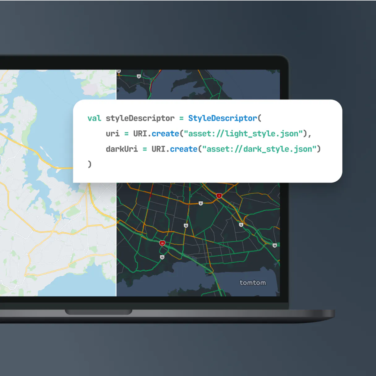
Give Claude and any AI agent real-world access
Translate any street address into accurate geographic coordinates or reverse the process to find a street name from given coordinates.
Calculate the necessary route, distance, and time needed for travel between two precise points using this MCP.
Scan a defined area to identify live traffic incidents or assess the current speed and quality of a specific road segment.
Search for categories like hospitals or gas stations near a location, retrieving key contact details along the way.
Calculate the maximum area (polygonal limit) your agents or vehicles can reach within a given time budget.
Ask an AI about this
Waiting for input…
What AI agents can do with TomTom: 10 Location Services Tools
Use these tools to calculate routes, estimate travel times, check live traffic flow, or find points of interest anywhere in the world.
Make your AI actually useful.
Add this MCP to Claude, Cursor, or Windsurf and your AI stops guessing. It gets real tools to look things up, take action, and handle the stuff you keep doing by hand.
Start using TomTom MCPCalculate Reachable Range
Determines the full area that can be covered, given a starting point and maximum travel time in seconds.
Calculate Route
Calculates the direct route polyline, total distance, and estimated driving time...
Search Poi By Category
Locates points of interest (POIs) near a coordinate by specifying a category like...
Fuzzy Geocoding
Converts an address string into precise coordinates, even if the input address has...
Get Poi Details
Retrieves detailed information and rich metadata for a specific point of interest ID...
Get Traffic Incidents
Pulls real-time details on traffic incidents, like accidents or construction, within any defined map boundaries.
Get Traffic Flow Segment
Retrieves the current speed and overall quality of travel for a specific segment of road at a given coordinate.
Reverse Geocoding
Converts geographic coordinates back into a readable, formatted street address...
Autocomplete Place Search
Offers predictive location suggestions as you type a partial place name or address...
Structured Geocoding
Converts an address into coordinates using required components like the country code...
Security and governance baked right in.
Pick your AI client below to get set up. Just create a Vinkius account, subscribe, and you're instantly up and running. We handle the entire backend infrastructure, delivering out-of-the-box support for HTTPS Streamable, SSE, and OAuth2—zero messy routing required.
Claude AI
Open Claude Settings
Go to claude.ai, click your profile icon, then navigate to Customize → Connectors.
Add Custom Connector
Click the "+" button and select Add custom connector. Paste your Vinkius endpoint URL:
https://edge.vinkius.com/[YOUR_TOKEN_HERE]/mcp
Replace [YOUR_TOKEN_HERE] with your token
from cloud.vinkius.com. For OAuth-protected servers, expand
Advanced settings to add credentials.
Start a conversation
Open a new chat. The TomTom integration is available immediately — no restart needed.
Choose How to Get Started
Build a custom MCP for your own tools, or connect a ready-made integration from our catalog.
Build Your Own
Turn any API into an MCP. Import a spec, define Agent Skills, or deploy with MCPFusion.
- Import from OpenAPI, Swagger, or YAML specs
- Create Agent Skills with progressive disclosure
- Deploy to edge with MCPFusion framework
- Built in DLP, auth, and compliance on each call
- Real time usage dashboard and cost metering
- Publish to catalog or keep private
Make Your AI Do More
Start with TomTom, then connect any of our 5,200+ other servers whenever your AI needs more. One click, no limits.
- Use this MCP plus 5,200+ others, all in one place
- Add new capabilities to your AI anytime you want
- Connections are secured and governed automatically
- Track usage and costs across all your servers
- Works with Claude, ChatGPT, Cursor, and more
- New servers added to the catalog weekly
Independent Platform Disclaimer: Vinkius is an independent platform and is not affiliated with, endorsed by, sponsored by, verified by, or otherwise authorized by TomTom. All third-party trademarks, logos, and brand names are the property of their respective owners. Their use on this website is strictly for informational purposes to identify service compatibility and interoperability.
VINKIUS CLOUD
Cloud Hosted
Managed infra
V8 Isolated
Sandboxed per request
Zero-Trust Proxy
No stored credentials
DLP Enforced
Policy on each call
GDPR Compliant
EU data residency
Token Compression
~60% cost reduction
Mapping out logistics without constantly switching between tools.
Right now, planning any complex multi-stop route means juggling five different tabs: one for the map, one for traffic alerts, one for address verification, and three others just to copy/paste coordinates. You spend more time managing the data flow than actually solving the problem.
With this MCP, you simply ask your agent a question like 'What's the best way to get from Point A to Point B right now?' The connector handles the geocoding, the routing calculation, and checks for real-time traffic conditions. You get a single, actionable answer.
TomTom MCP delivers immediate operational context.
You no longer have to manually verify addresses using fuzzy_geocoding before running calculate_route, nor do you need separate searches for POIs and their contact details. All that data is available in one sequence of operations.
The difference is the complexity level. You move from writing multi-step code blocks with external API calls to asking a single, intelligent question.
What TomTom MCP does for your AI
This connector lets you bring enterprise-grade location intelligence directly into your chat workflow. You can turn messy physical addresses into exact latitude/longitude pairs, and vice versa, so your agent always knows precisely where something is. Need to plan a trip? Input two coordinates, and the tool calculates the optimal route polyline, total distance, and estimated travel time, factoring in current conditions.
It even maps out live traffic incidents—like accidents or construction zones—within any bounding box you define. If you're managing assets, you can figure out exactly how far your fleet can drive given a set time limit. Connecting this MCP through Vinkius gives your AI client immediate access to thousands of location services, making complex logistics questions simple chat queries.
019d7614-3803-7163-a858-cae0c9e01304 How to set up TomTom MCP
The bottom line is, you stop writing complex API calls and start asking natural questions about geography and logistics.
First, add this marketplace component to your workflow. Then, grab a secure API token from the TomTom Developer Portal.
Plug that key into the MCP and let your agent know what coordinates or addresses it needs to process.
Your AI client processes the request and returns structured data like polyline routes, traffic reports, or specific location metadata.
Who uses TomTom MCP
This MCP is critical for Logistics Engineers who need to model complex travel constraints or Fleet Managers who must continuously audit road conditions. If your job involves calculating anything based on physical location, you need this.
You use the MCP to test route shedding and determine maximum operational time boundaries for new service areas.
You ask your agent to check real-time traffic incidents across a region before dispatching routes, saving hours of manual checks.
You programmatically pull local points of interest strings and their contact details directly into an application's database setup.
Benefits of connecting TomTom MCP
Stop guessing addresses. Use fuzzy_geocoding or structured_geocoding to guarantee precise coordinates from any input string, even if it's messy.
Get immediate route planning by calling calculate_route. You get the polyline geometry and travel time summary in one query, skipping multiple API calls.
Monitor road conditions instantly. Use get_traffic_incidents to map live accidents or use get_traffic_flow_segment to check if a specific avenue is backed up.
Never lose track of resources. The calculate_reachable_range tool tells you exactly how far your vehicles can go based on time and starting point.
Discover local services without leaving the chat. Search for POIs using search_poi_by_category, then get all the contact info via get_poi_details.
TomTom MCP use cases
Dispatching a repair crew after an accident.
The manager asks: 'Check for traffic incidents near Lat 34.05, Lon -118.25.' The agent uses get_traffic_incidents to confirm an accident and then uses calculate_reachable_range to see if the crew can reach it within a two-hour window.
Mapping out service zones for expansion.
A developer asks: 'What area around this warehouse can we serve in 4 hours?' The agent calls calculate_reachable_range, providing the precise polygonal limit of potential new territory.
Validating customer-provided addresses.
The user inputs a handwritten address. The agent uses fuzzy_geocoding to convert it into validated coordinates, and then reverse_geocoding confirms the exact street name for billing records.
Optimizing delivery schedules in a new city.
The planner asks: 'What is the fastest route between these three points?' The agent uses calculate_route multiple times and compares results, factoring in current real-time traffic data for maximum efficiency.
TomTom MCP tradeoffs
What to watch out for, and the recommended way to handle each one.
Assuming coordinates are always perfect.
A user tries to calculate a route using only an address like 'Main Street' because they think the AI will figure it out.
First, use fuzzy_geocoding or structured_geocoding to convert that vague address into guaranteed latitude/longitude coordinates. Then, feed those precise numbers into calculate_route for accurate results.
Treating traffic data as simple on/off switches.
Asking if 'traffic is bad' without defining an area or time frame, leading to vague answers.
To get specific information, use a bounding box with get_traffic_incidents. If you need general flow quality, check the speed using get_traffic_flow_segment.
Trying to find POIs without knowing what type they are.
Simply asking 'what's around here?' results in an overwhelming list of irrelevant businesses.
Be specific. Use search_poi_by_category and name the category (e.g., 'pharmacy'). Then, use get_poi_details to pull out opening hours.
When to use TomTom MCP
Use this TomTom MCP if your workflow is fundamentally about physical location: routing, time-based service areas, or geo-validation. If you need to calculate how far a vehicle can go in 3 hours, use calculate_reachable_range. If you just need the straight line distance between two known coordinates, calculate_route works too. Don't use this if your problem is purely data aggregation (like joining spreadsheets) or complex natural language reasoning without location context; those require different tools. However, if you are dealing with vague inputs and need to ensure coordinate accuracy before any calculation, structured_geocoding is your required first step. If all you have are coordinates but need a street name for billing, reverse_geocoding handles that perfectly.
Frequently asked questions about TomTom MCP
How does TomTom MCP handle bad addresses? +
It uses fuzzy_geocoding and structured_geocoding. These tools can convert physical address strings into accurate coordinates even if the input is messy or incomplete.
Can I find traffic information for a whole region? +
Yes, you use get_traffic_incidents by providing minimum and maximum latitude/longitude boundaries. This gives you an overview of accidents and jams in that entire box.
Is calculate_route just straight-line distance? +
No. calculate_route calculates the actual polyline geometry, total distance, and estimated travel time based on typical road networks, not just a straight line through space.
How do I get contact information for a business near me? +
First, use search_poi_by_category to locate the point of interest. Then, call get_poi_details using its unique ID to pull out rich metadata like phone numbers and hours.
Does TomTom MCP account for travel time limitations? +
Yes. The calculate_reachable_range tool determines the exact polygonal area you can reach given a specific time budget in seconds.