Bring Geocoding
to OpenAI Agents SDK
Create your Vinkius account to connect Jawg Maps (Location & Routing) to OpenAI Agents SDK and start using all 10 AI tools in minutes. Fully managed, enterprise secure, and ready to use without writing a single line of code. No hosting, no server setup — just connect and start using.
Compatible with every major AI agent and IDE
 Gemini
What is the Jawg Maps (Location & Routing) MCP Server?
Connect your Jawg Maps account to any AI agent and take full control of professional map services and geospatial analytics through natural conversation.
What you can do
- Place Search & Geocoding — Find addresses and points of interest (POI) by text or resolve GPS coordinates to physical locations directly from your agent
- Advanced Routing — Calculate optimal paths for driving, biking, or walking with support for multiple waypoints and transportation profiles
- Distance Matrices — Compute massive travel time and distance tables between multiple origins and destinations for logistics optimization
- Reachability Isochrones — Visualize reachable areas from a center point based on precise travel time or distance limits (drive-time polygons)
- Elevation Profiles — Retrieve the altitude and elevation above sea level for specific coordinates or along a calculated route path
- Geo-Filtering — Perform restricted searches within specific ISO country borders to ensure data accuracy and regional compliance
How it works
- Subscribe to this server
- Enter your Jawg Access Token
- Start building location-aware applications from Claude, Cursor, or any MCP-compatible client
Who is this for?
- GIS Developers — integrate geocoding and routing services into AI agents and test API results through natural conversation
- Logistics Planners — calculate optimal routes and distance matrices for delivery fleets and supply chain management
- Urban Researchers — analyze city accessibility and elevation data across different geographic regions efficiently
Built-in capabilities (10)
Calculate the area reachable within a given distance limit
Compute travel times and distances between multiple origins and destinations
Calculate a route that includes elevation profiles
Calculate the area reachable within a given time limit
) passing through the provided waypoints. Calculate a route between multiple coordinates
Get elevation data for specific coordinates
Get address information from GPS coordinates
You can optionally bias results towards a specific GPS location. Autocomplete a place or address search query
Search for places with a strict country filter
Returns matching locations with their coordinates. Search for places and addresses by text
Why OpenAI Agents SDK?
The OpenAI Agents SDK auto-discovers all 10 tools from Jawg Maps (Location & Routing) through native MCP integration. Build agents with built-in guardrails, tracing, and handoff patterns. chain multiple agents where one queries Jawg Maps (Location & Routing), another analyzes results, and a third generates reports, all orchestrated through Vinkius.
- —
Native MCP integration via
MCPServerSse, pass the URL and the SDK auto-discovers all tools with full type safety - —
Built-in guardrails, tracing, and handoff patterns let you build production-grade agents without reinventing safety infrastructure
- —
Lightweight and composable: chain multiple agents and MCP servers in a single pipeline with minimal boilerplate
- —
First-party OpenAI support ensures optimal compatibility with GPT models for tool calling and structured output
Jawg Maps (Location & Routing) in OpenAI Agents SDK
Why run Jawg Maps (Location & Routing) with Vinkius?
The Jawg Maps (Location & Routing) connection runs on our fully managed, secure cloud infrastructure. We handle the hosting, maintenance, and security so you don't have to deal with servers or code. All 10 tools are ready to work instantly without any complex setup.
You stay in complete control of your data. Your AI only accesses the information you approve, keeping your sensitive passwords and private details completely safe. Plus, with automatic optimizations, your AI works faster and more efficiently.
* Every connection is hosted and maintained by Vinkius. We handle the security, updates, and infrastructure so you don't have to write code or manage servers. See our infrastructure
Over 4,000 integrations ready for AI agents
Explore a vast library of pre-built integrations, optimized and ready to deploy.
Connect securely in under 30 seconds
Generate tokens to authenticate and link external services in a single step.
Complete visibility into every agent action
Audit live requests, latency, success rates, and active security compliance policies.
Optimize spending and track token ROI
Analyze real-time token consumption and cost metrics detailed by connection.


Explore our live AI Agents Analytics dashboard to see it all working
This dashboard is included when you connect Jawg Maps (Location & Routing) using Vinkius. You will never be left in the dark about what your AI agents are doing with your tools.
Jawg Maps (Location & Routing) and 4,000+ other AI tools. No hosting, no code, ready to use.
Professionals who connect Jawg Maps (Location & Routing) to OpenAI Agents SDK through Vinkius don't need to write code, manage servers, or worry about security. Everything is pre-configured, secure, and runs automatically in the background.
Raw MCP | Vinkius | |
|---|---|---|
| Ready-to-use MCPs | Find and configure each manually | 4,000+ MCPs ready to use |
| Connection Setup | Manual coding & server setup | 1-click instant connection |
| Server Hosting | You host it yourself (needs 24/7 uptime) | 100% hosted & managed by Vinkius |
| Security & Privacy | Stored in plaintext config files | Bank-grade encrypted vault |
| Activity Visibility | Blind execution (no logs or tracking) | Live dashboard with real-time logs |
| Cost Control | Runaway AI token spend risk | Automatic budget limits |
| Revoking Access | Must delete files or code to stop | 1-click disconnect button |
How Vinkius secures
Jawg Maps (Location & Routing) for OpenAI Agents SDK
Every request between OpenAI Agents SDK and Jawg Maps (Location & Routing) is protected by our secure gateway. We automatically keep your sensitive data private, prevent unauthorized access, and let you disconnect instantly at any time.
Frequently asked questions
Can I calculate how far I can travel in 15 minutes from my current location?
Yes. Use the calculate_reachability_isochrone tool by providing your center coordinates and a range of 900 seconds. Your agent will return a polygon representing the reachable area, perfect for analyzing site accessibility.
How do I find the elevation profile along a delivery route?
The calculate_elevation_routing tool calculates detailed paths that include Z-axis data. Your agent will return the routing instructions along with the altitude for each point, helping you optimize for heavy loads or fuel consumption.
Can I compute travel times between dozens of points at once?
Absolutely. Use the calculate_distance_matrix tool to submit arrays of origin and destination coordinates. Your agent will return a matrix of durations and distances, making it ideal for fleet route optimization.
How does the OpenAI Agents SDK connect to MCP?
Use MCPServerSse(url=...) to create a server connection. The SDK auto-discovers all tools and makes them available to your agent with full type information.
Can I use multiple MCP servers in one agent?
Yes. Pass a list of MCPServerSse instances to the agent constructor. The agent can use tools from all connected servers within a single run.
Does the SDK support streaming responses?
Yes. The SDK supports SSE and Streamable HTTP transports, both of which work natively with Vinkius.
MCPServerStreamableHttp not found
Ensure you have the latest version: pip install --upgrade openai-agents
Agent not calling tools
Make sure your prompt explicitly references the task the tools can help with.
Explore More MCP Servers
View all →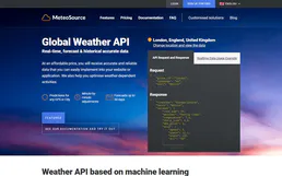
MeteoSource
5 toolsMonitor global weather — audit forecasts and places via AI.

Bureau24
10 toolsNever miss a business call with a live virtual receptionist service that answers, routes, and logs calls professionally.
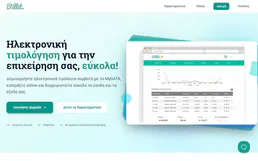
Billit
9 toolsManage your e-invoicing via Billit — list invoices, clients, and expenses directly from any AI agent.

EPA ECHO (Enforcement & Compliance)
7 toolsAccess US EPA environmental compliance data — search facilities, inspect air/water permits, and analyze enforcement history directly.