Bring Satellite Imagery
to Cline
Create your Vinkius account to connect Farmonaut to Cline and start using all 12 AI tools in minutes. Fully managed, enterprise secure, and ready to use without writing a single line of code. No hosting, no server setup — just connect and start using.
Compatible with every major AI agent and IDE
 Gemini
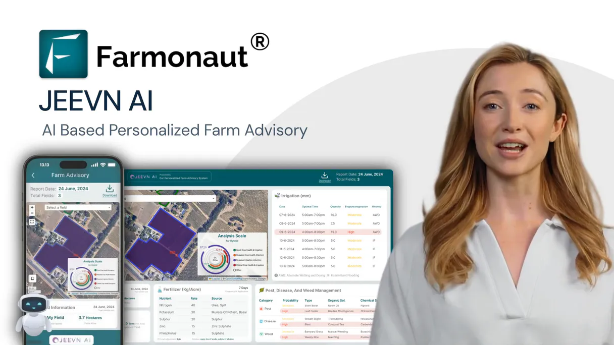
What is the Farmonaut MCP Server?
Connect your Farmonaut Satellite API to any AI agent and take full control of satellite-based crop monitoring, vegetation index analysis, weather tracking, AI crop advisory, and deforestation detection through natural conversation.
What you can do
- Field Management — List and register agricultural fields with boundaries, crop types, and planting dates
- NDVI Analysis — Calculate NDVI from Sentinel-2, Landsat, and PlanetScope for crop health monitoring
- NDWI Water Index — Monitor crop water content and irrigation needs with water index analysis
- EVI Enhanced Index — Track enhanced vegetation index for high-biomass and dense canopy crops
- Weather Data — Access historical and current weather data for agricultural decision making
- Weather Forecast — Get forecasts from 7 days to 3 months for agricultural planning
- Soil Moisture — Monitor soil moisture at different depths for irrigation scheduling
- Satellite Imagery — Retrieve true-color, false-color, and NDVI overlay images from multiple satellites
- AI Crop Advisory — Get AI-powered recommendations for irrigation, fertilizer, pest control, and harvest
- Deforestation Alerts — Detect land use changes and tree cover loss for conservation compliance
- SAR Analysis — All-weather monitoring using Synthetic Aperture Radar that penetrates clouds
- Multi-Satellite Support — Access Sentinel-2, Landsat, PlanetScope, and SAR satellite data
How it works
- Subscribe to this server
- Enter your Farmonaut API key (from the dashboard API section)
- Start monitoring crops from Claude, Cursor, or any MCP-compatible client
No more manual satellite data analysis or complex GIS workflows. Your AI acts as a dedicated precision agriculture analyst and farm management assistant.
Who is this for?
- Farm Managers — monitor crop health across all fields, plan irrigation, and optimize inputs
- Agronomists — analyze vegetation indices, track growth stages, and detect crop stress early
- Agricultural Consultants — provide AI-powered advisories and assess field productivity
- Conservation Teams — monitor deforestation, land use changes, and environmental compliance
Built-in capabilities (12)
Accepts field boundary as GeoJSON polygon or coordinates, field name, crop type, and planting date. Returns the created field with ID, calculated area, and monitoring activation status. Essential for onboarding new fields into the monitoring system, expanding farm coverage, and setting up new crop seasons. AI agents should use this when users ask "add a new field for monitoring", "register this field boundary", or need to set up satellite monitoring for a new agricultural area. Register a new agricultural field for satellite monitoring
Returns recommendations for irrigation, fertilization, pest control, harvest timing, and field operations. Essential for data-driven farm management, precision agriculture, and optimizing crop inputs. AI agents should use this when users ask "what should I do in my field this week", "get irrigation and fertilizer recommendations", or need AI-powered crop management advice. Get AI-powered crop management advisories and recommendations
Uses satellite imagery to detect tree cover loss, land clearing, and vegetation changes over time. Essential for conservation compliance, environmental monitoring, carbon credit verification, and land use change detection. AI agents should reference this when users ask "show deforestation alerts in my area", "detect land use changes", or need environmental compliance monitoring. Get deforestation and land change detection alerts
EVI is more sensitive in high-biomass regions and less affected by atmospheric conditions and soil background than NDVI. Essential for monitoring dense canopies, tropical crops, and areas with high atmospheric interference. Returns EVI values, statistics, satellite source, and acquisition dates. AI agents should use this when users ask "show me EVI trends for this field", "how is the canopy developing in high-biomass areas", or need enhanced vegetation index analysis for dense vegetation. Calculate EVI enhanced vegetation index for high-biomass crop monitoring
Returns field names, boundaries (GeoJSON polygons), area in hectares/acres, crop type, planting dates, and current monitoring status. Essential for farm management overview, field inventory, and selecting target fields for satellite analysis. AI agents should use this when users ask "show me all my fields", "list monitored fields", or need to identify available fields for vegetation index or weather queries. List all agricultural fields monitored in your Farmonaut account
NDVI measures vegetation health and vigor on a scale of -1 to 1, with higher values indicating healthier vegetation. Returns NDVI values, statistics (mean, min, max, std), satellite source, acquisition date, and cloud cover percentage. Essential for crop health assessment, growth stage monitoring, stress detection, and yield prediction. AI agents should use this when users ask "what is the NDVI for my rice field this month", "calculate vegetation health for field X", or need NDVI-based crop health analysis. Calculate NDVI vegetation index for crop health monitoring
NDWI is sensitive to vegetation water content and soil moisture, making it essential for irrigation scheduling, drought monitoring, and water stress detection. Returns NDWI values, statistics, satellite source, and acquisition dates. AI agents should reference this when users ask "what is the water content in my crops", "do I need to irrigate", or need water stress analysis for irrigation planning. Calculate NDWI water index for crop water stress and irrigation monitoring
SAR penetrates clouds and works day/night, making it essential for monitoring in cloudy or rainy conditions. Returns backscatter values, soil moisture estimates, crop structure information, and change detection analysis. Essential for all-weather monitoring, flood detection, soil moisture mapping, and crop structure analysis. AI agents should use this when users ask "get SAR analysis for my field during cloudy season", "monitor crops through cloud cover", or need all-weather satellite analysis. Get Synthetic Aperture Radar (SAR) analysis for all-weather crop monitoring
Returns true-color and false-color composites, NDVI overlays, and raw spectral bands. Essential for visual crop assessment, change detection, damage assessment, and downloading imagery for further processing. AI agents should reference this when users ask "show me satellite images of my field from last week", "get latest Sentinel-2 imagery", or need satellite imagery for visual assessment. Retrieve satellite imagery for agricultural fields from multiple sources
Returns soil moisture levels at different depths (surface, root zone, deep soil), moisture anomalies, and irrigation recommendations. Essential for irrigation scheduling, drought monitoring, water stress detection, and water resource optimization. AI agents should use this when users ask "what is the soil moisture level in my field", "do I need to irrigate", or need soil moisture data for irrigation planning. Get soil moisture data for irrigation scheduling and drought monitoring
Includes temperature (air, soil), precipitation, humidity, wind speed/direction, solar radiation, evapotranspiration, and growing degree days. Essential for irrigation planning, frost risk assessment, disease/pest pressure modeling, and yield prediction. AI agents should use this when users ask "what was the weather like on my field last month", "get temperature and rainfall data", or need historical weather analysis for crop management decisions. Get historical and current weather data for agricultural fields
Includes temperature, precipitation, humidity, wind, and solar radiation forecasts. Essential for planting schedule optimization, harvest timing, irrigation planning, frost protection, and seasonal crop management. AI agents should reference this when users ask "what is the weather forecast for my field next week", "get seasonal precipitation forecast", or need forward-looking weather data for agricultural planning. Get weather forecasts for agricultural planning and irrigation scheduling
Why Cline?
Cline operates autonomously inside VS Code. it reads your codebase, plans a strategy, and executes multi-step tasks including Farmonaut tool calls without waiting for prompts between steps. Connect 12 tools through Vinkius and Cline can fetch data, generate code, and commit changes in a single autonomous run.
- —
Cline operates autonomously. it reads your codebase, plans a strategy, and executes multi-step tasks including MCP tool calls without step-by-step prompts
- —
Runs inside VS Code, so you get MCP tool access alongside your existing extensions, terminal, and version control in a single window
- —
Cline can create, edit, and delete files based on MCP tool responses, enabling end-to-end automation from data retrieval to code generation
- —
Transparent execution: every tool call and file change is shown in Cline's activity log for full visibility and approval before committing
Farmonaut in Cline
Why run Farmonaut with Vinkius?
The Farmonaut connection runs on our fully managed, secure cloud infrastructure. We handle the hosting, maintenance, and security so you don't have to deal with servers or code. All 12 tools are ready to work instantly without any complex setup.
You stay in complete control of your data. Your AI only accesses the information you approve, keeping your sensitive passwords and private details completely safe. Plus, with automatic optimizations, your AI works faster and more efficiently.
* Every connection is hosted and maintained by Vinkius. We handle the security, updates, and infrastructure so you don't have to write code or manage servers. See our infrastructure
Over 4,000 integrations ready for AI agents
Explore a vast library of pre-built integrations, optimized and ready to deploy.
Connect securely in under 30 seconds
Generate tokens to authenticate and link external services in a single step.
Complete visibility into every agent action
Audit live requests, latency, success rates, and active security compliance policies.
Optimize spending and track token ROI
Analyze real-time token consumption and cost metrics detailed by connection.


Explore our live AI Agents Analytics dashboard to see it all working
This dashboard is included when you connect Farmonaut using Vinkius. You will never be left in the dark about what your AI agents are doing with your tools.
Farmonaut and 4,000+ other AI tools. No hosting, no code, ready to use.
Professionals who connect Farmonaut to Cline through Vinkius don't need to write code, manage servers, or worry about security. Everything is pre-configured, secure, and runs automatically in the background.
Raw MCP | Vinkius | |
|---|---|---|
| Ready-to-use MCPs | Find and configure each manually | 4,000+ MCPs ready to use |
| Connection Setup | Manual coding & server setup | 1-click instant connection |
| Server Hosting | You host it yourself (needs 24/7 uptime) | 100% hosted & managed by Vinkius |
| Security & Privacy | Stored in plaintext config files | Bank-grade encrypted vault |
| Activity Visibility | Blind execution (no logs or tracking) | Live dashboard with real-time logs |
| Cost Control | Runaway AI token spend risk | Automatic budget limits |
| Revoking Access | Must delete files or code to stop | 1-click disconnect button |
How Vinkius secures
Farmonaut for Cline
Every request between Cline and Farmonaut is protected by our secure gateway. We automatically keep your sensitive data private, prevent unauthorized access, and let you disconnect instantly at any time.
Frequently asked questions
Can my AI calculate NDVI for my rice field and show me the crop health trend?
Yes! Use the get_ndvi tool with your field ID and date range (e.g., date_from=2025-04-01, date_to=2025-10-31). This returns NDVI values for each satellite overpass from Sentinel-2, Landsat, or PlanetScope, showing vegetation health progression. You can also use get_crop_advisory for AI-powered recommendations based on the NDVI trends and current growth stage.
How do I get soil moisture and weather forecast data to plan irrigation?
Use get_soil_moisture with your field ID and date range to check current soil moisture levels at root zone depth. Combine with get_weather_forecast (forecast_range=7_days or 15_days) to see upcoming precipitation. Together these tools help determine if and when irrigation is needed. For AI-powered irrigation recommendations, use get_crop_advisory with advisory_type=irrigation.
Can I monitor my crops during cloudy season when optical satellites cannot see?
Yes! Use the get_sar_analysis tool which uses Synthetic Aperture Radar (SAR) data that penetrates clouds and works day/night. SAR provides backscatter values, soil moisture estimates, and crop structure information regardless of weather conditions. This is essential for monitoring in tropical regions, monsoon seasons, or any cloudy conditions where optical satellites like Sentinel-2 cannot provide clear imagery.
How does Cline connect to MCP servers?
Cline reads MCP server configurations from its settings panel in VS Code. Add the server URL and Cline discovers all available tools on initialization.
Can Cline run MCP tools without approval?
By default, Cline asks for confirmation before executing tool calls. You can configure auto-approval rules for trusted servers in the settings.
Does Cline support multiple MCP servers at once?
Yes. Configure as many servers as needed. Cline can use tools from different servers within the same autonomous task execution.
Server shows error in sidebar
Click the server name to see logs. Verify the URL and token are correct.
Explore More MCP Servers
View all →
PG&E Data Portals
10 toolsSearch and query PG&E energy datasets: usage, EV adoption, solar, grid data.

PayPal
10 toolsManage e-commerce payments via PayPal — orchestrate orders, process captures securely, issue refunds natively, and structure active subscriptions using AI.

Mercury
10 toolsEquip your AI agent with direct access to Mercury — check account balances, review transactions, and manage recipients without opening the banking dashboard.

WooCommerce Alternative
10 toolsManage your WooCommerce store — audit products, orders, and reports via AI.