Bring Satellite Imagery
to CrewAI
Create your Vinkius account to connect Planet Labs to CrewAI and start using all 12 AI tools in minutes. Fully managed, enterprise secure, and ready to use without writing a single line of code. No hosting, no server setup — just connect and start using.
Compatible with every major AI agent and IDE
 Gemini
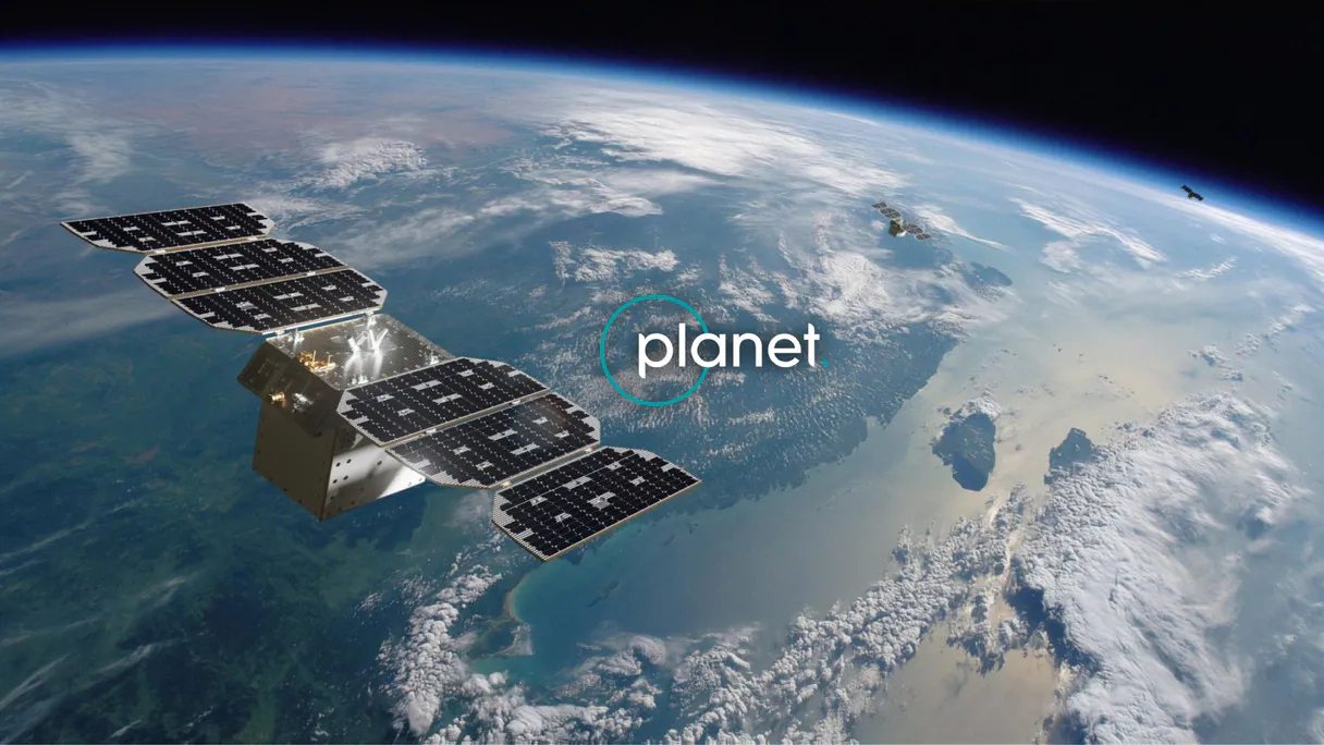
What is the Planet Labs MCP Server?
Connect your Planet Labs API to any AI agent and take full control of daily satellite imagery search, discovery, automated delivery, and imagery analysis through natural conversation.
What you can do
- Quick Search — Search for satellite imagery with geometry, date range, cloud cover, and sun elevation filters
- Saved Searches — Create and manage saved searches for recurring imagery monitoring workflows
- Search Results — Execute saved searches with pagination and sorting to retrieve imagery results
- Search Statistics — Get histograms of imagery availability by time interval for planning analysis
- Item Details — View detailed metadata for specific imagery items including acquisition conditions
- Asset Discovery — List all available asset types (visual, analytic, UDM2) for each imagery item
- Item Types — Browse all available satellite imagery types (PSScene, SkySat, RapidEye, Landsat, Sentinel-2)
- Asset Types — Understand available data products (true-color, surface reflectance, uncertainty masks)
- Cloud Coverage — Estimate clear area percentage before downloading imagery for quality assessment
- Subscriptions — List and create automated subscriptions for continuous cloud delivery of imagery
- Multi-Satellite Access — Search across PlanetScope (3-5m), SkySat (sub-meter), RapidEye (5m), Landsat (30m), and Sentinel-2 (10m)
- Global Daily Coverage — Access daily imagery of Earth landmass with 200+ PlanetScope satellites
How it works
- Subscribe to this server
- Enter your Planet API key (from My Settings in your Planet account)
- Start searching satellite imagery from Claude, Cursor, or any MCP-compatible client
No more manual satellite catalog browsing or complex GIS workflows. Your AI acts as a dedicated satellite imagery analyst and data acquisition assistant.
Who is this for?
- Agriculture Teams — monitor crop health with daily cloud-free imagery and NDVI analysis
- Environmental Scientists — track deforestation, wetland changes, and habitat loss over time
- Disponse Response Teams — rapidly acquire pre and post-event imagery for damage assessment
- GIS Professionals — discover, evaluate, and download satellite imagery for mapping projects
Built-in capabilities (12)
Accepts the same filter parameters as quick_search including geometry, date range, cloud cover, and item types. Returns a search ID that can be used with get_search_results to execute the search on demand. Essential for automated monitoring, change detection workflows, and recurring imagery retrieval. AI agents should use this when users ask "set up a search for new imagery over my field every week", "create a saved search for cloud-free images", or need to establish recurring imagery monitoring for a specific area. Create a saved search for continuous imagery monitoring
Accepts geometry, date range, cloud cover filters, item types, and delivery destination (cloud storage or webhook). Returns the created subscription with ID and status. Essential for setting up automated monitoring, establishing continuous data feeds for change detection, and ensuring regular imagery delivery for operational workflows. AI agents should use this when users ask "set up daily imagery delivery for my farm", "create a subscription for cloud-free images over this area", or need to establish automated imagery delivery for monitoring applications. Create a new subscription for continuous automated imagery delivery
Returns clear percentage, cloud percentage, and status information. Essential for quality assessment before downloading imagery, filtering cloudy images from analysis workflows, and ensuring usable imagery for visual interpretation. AI agents should use this when users ask "how cloudy is this image", "what percentage of this scene is clear", or need to assess imagery quality before committing to download. Estimate cloud coverage and clear area percentage for a specific imagery item
Each asset includes download URLs, file sizes, and permissions. Essential for selecting the appropriate data product for analysis, downloading imagery for GIS processing, and understanding available data products. AI agents should use this when users ask "what assets are available for this image", "get download URLs for analytic imagery", or need to select specific asset types (visual for display, analytic for analysis) for download. List all available asset types (visual, analytic, UDM) for a specific imagery item
Essential for evaluating image quality before download, understanding acquisition conditions, and preparing orders for specific imagery. AI agents should reference this when users ask "show me details for this image", "what is the cloud cover and acquisition time for item X", or need to evaluate imagery quality before downloading. Get detailed metadata for a specific satellite imagery item
Supports pagination (page, page_size) and sorting (acquired asc/desc, published asc/desc). Returns imagery items with acquisition dates, cloud cover, geometry, and available asset types. Essential for retrieving results from pre-configured monitoring searches and executing recurring imagery queries. AI agents should use this when users ask "run my Weekly Farm Monitoring search", "get results from saved search X", or need to execute a saved search and retrieve the latest imagery results. Execute a saved search and retrieve imagery results
Essential for understanding imagery availability patterns, planning data collection schedules, and assessing temporal coverage for change detection analysis. AI agents should use this when users ask "how many images are available per month for my area", "show me imagery availability statistics", or need to understand temporal patterns of satellite coverage before setting up monitoring. Get statistical histograms of available imagery for an area and time period
Returns asset type IDs, display names, and descriptions. Essential for selecting the appropriate data product for specific use cases (visual for visualization, analytic for NDVI calculation, UDM for quality filtering). AI agents should reference this when users ask "what asset types can I download", "difference between analytic and visual assets", or need to understand available data products for analysis. List all available asset types (visual, analytic, UDM, etc.) and their properties
Returns item type IDs, display names, and supported asset types for each. Essential for understanding available imagery sources, selecting appropriate resolution and coverage for analysis, and planning data acquisition strategies. AI agents should use this when users ask "what satellite imagery types are available", "compare PSScene vs SkySat resolution", or need to understand the full catalog of Planet imagery options. List all available satellite imagery item types and their supported assets
Returns search names, IDs, filter criteria, item types, and creation dates. Essential for managing monitoring workflows, reviewing existing search configurations, and selecting searches for execution. AI agents should reference this when users ask "show me all my saved searches", "list my monitoring configurations", or need to review existing saved searches before executing them. List all saved searches in your Planet account
Returns subscription names, IDs, filter criteria, delivery destinations, and status. Essential for monitoring automated imagery delivery, reviewing subscription configurations, and managing continuous data feeds. AI agents should reference this when users ask "show me all my subscriptions", "list automated imagery deliveries", or need to review existing subscription configurations. List all active imagery subscriptions for continuous cloud delivery
Supports item types including PSScene (PlanetScope, 3-5m resolution, daily global coverage), SkySat (sub-meter resolution, high-detail), RapidEye (5m resolution, historical archive), Landsat 8/9 (30m resolution, USGS), and Sentinel-2 (10m resolution, ESA). Returns imagery items with acquisition dates, cloud cover percentages, sun elevation, instrument mode, geometry, and available asset types. Essential for satellite imagery discovery, change detection analysis, disaster monitoring, and agricultural assessment. AI agents should use this when users ask "find cloud-free imagery over this area from last month", "search for PSScene images of my farm", or need to discover available satellite imagery for a specific location and time period. Geometry must be provided as GeoJSON (Point, Polygon, or MultiPolygon). Date filtering uses the acquired property in ISO 8601 format. Cloud cover and sun elevation are filtered using the filter object with range operators. Search for satellite imagery from Planet Labs with geometry, date, and cloud cover filters
Why CrewAI?
When paired with CrewAI, Planet Labs becomes a first-class tool in your multi-agent workflows. Each agent in the crew can call Planet Labs tools autonomously, one agent queries data, another analyzes results, a third compiles reports, all orchestrated through Vinkius with zero configuration overhead.
- —
Multi-agent collaboration lets you decompose complex workflows into specialized roles, one agent researches, another analyzes, a third generates reports, each with access to MCP tools
- —
CrewAI's native MCP integration requires zero adapter code: pass Vinkius Edge URL directly in the
mcpsparameter and agents auto-discover every available tool at runtime - —
Built-in task delegation and shared memory mean agents can pass context between steps without manual state management, enabling multi-hop reasoning across tool calls
- —
Sequential and hierarchical crew patterns map naturally to real-world workflows: enumerate subdomains → analyze DNS history → check WHOIS records → compile findings into actionable reports
Planet Labs in CrewAI
Why run Planet Labs with Vinkius?
The Planet Labs connection runs on our fully managed, secure cloud infrastructure. We handle the hosting, maintenance, and security so you don't have to deal with servers or code. All 12 tools are ready to work instantly without any complex setup.
You stay in complete control of your data. Your AI only accesses the information you approve, keeping your sensitive passwords and private details completely safe. Plus, with automatic optimizations, your AI works faster and more efficiently.
* Every connection is hosted and maintained by Vinkius. We handle the security, updates, and infrastructure so you don't have to write code or manage servers. See our infrastructure
Over 4,000 integrations ready for AI agents
Explore a vast library of pre-built integrations, optimized and ready to deploy.
Connect securely in under 30 seconds
Generate tokens to authenticate and link external services in a single step.
Complete visibility into every agent action
Audit live requests, latency, success rates, and active security compliance policies.
Optimize spending and track token ROI
Analyze real-time token consumption and cost metrics detailed by connection.


Explore our live AI Agents Analytics dashboard to see it all working
This dashboard is included when you connect Planet Labs using Vinkius. You will never be left in the dark about what your AI agents are doing with your tools.
Planet Labs and 4,000+ other AI tools. No hosting, no code, ready to use.
Professionals who connect Planet Labs to CrewAI through Vinkius don't need to write code, manage servers, or worry about security. Everything is pre-configured, secure, and runs automatically in the background.
Raw MCP | Vinkius | |
|---|---|---|
| Ready-to-use MCPs | Find and configure each manually | 4,000+ MCPs ready to use |
| Connection Setup | Manual coding & server setup | 1-click instant connection |
| Server Hosting | You host it yourself (needs 24/7 uptime) | 100% hosted & managed by Vinkius |
| Security & Privacy | Stored in plaintext config files | Bank-grade encrypted vault |
| Activity Visibility | Blind execution (no logs or tracking) | Live dashboard with real-time logs |
| Cost Control | Runaway AI token spend risk | Automatic budget limits |
| Revoking Access | Must delete files or code to stop | 1-click disconnect button |
How Vinkius secures
Planet Labs for CrewAI
Every request between CrewAI and Planet Labs is protected by our secure gateway. We automatically keep your sensitive data private, prevent unauthorized access, and let you disconnect instantly at any time.
Frequently asked questions
Can my AI search for cloud-free satellite imagery over my farm from last month?
Yes! Use the quick_search tool with your farm boundary as GeoJSON geometry, date range for last month, item_types=PSScene, and max_cloud_cover=10 (for 10% or less cloud cover). The search returns all available imagery matching your criteria with acquisition dates, cloud cover percentages, and download URLs for visual and analytic assets. For ongoing monitoring, create a saved search with create_saved_search and execute it regularly with get_search_results.
What is the difference between PSScene, SkySat, and RapidEye imagery?
PSScene (PlanetScope) provides daily global coverage at 3-5m resolution with 200+ satellites, ideal for broad-area monitoring and time-series analysis. SkySat offers sub-meter resolution (0.5-0.9m) with video capability, perfect for detailed inspection of specific sites. RapidEye provides 5m resolution with a 5-band sensor (including red-edge) and a deep historical archive dating back to 2009. Use list_item_types to see all available imagery types and their supported asset types.
How do I set up automated daily imagery delivery for my area of interest?
Use the create_subscription tool with your area geometry, item types (e.g., PSScene), and cloud cover filter. You can specify delivery to AWS S3, Google Cloud Storage, Azure Blob, or webhook endpoints. The subscription will continuously deliver new imagery matching your criteria as it becomes available. To manage existing subscriptions, use list_subscriptions to review and monitor active deliveries.
How does CrewAI discover and connect to MCP tools?
CrewAI connects to MCP servers lazily. when the crew starts, each agent resolves its MCP URLs and fetches the tool catalog via the standard tools/list method. This means tools are always fresh and reflect the server's current capabilities. No tool schemas need to be hardcoded.
Can different agents in the same crew use different MCP servers?
Yes. Each agent has its own mcps list, so you can assign specific servers to specific roles. For example, a reconnaissance agent might use a domain intelligence server while an analysis agent uses a vulnerability database server.
What happens when an MCP tool call fails during a crew run?
CrewAI wraps tool failures as context for the agent. The LLM receives the error message and can decide to retry with different parameters, fall back to a different tool, or mark the task as partially complete. This resilience is critical for production workflows.
Can CrewAI agents call multiple MCP tools in parallel?
CrewAI agents execute tool calls sequentially within a single reasoning step. However, you can run multiple agents in parallel using process=Process.parallel, each calling different MCP tools concurrently. This is ideal for workflows where separate data sources need to be queried simultaneously.
Can I run CrewAI crews on a schedule (cron)?
Yes. CrewAI crews are standard Python scripts, so you can invoke them via cron, Airflow, Celery, or any task scheduler. The crew.kickoff() method runs synchronously by default, making it straightforward to integrate into existing pipelines.
MCP tools not discovered
Ensure the Edge URL is correct. CrewAI connects lazily when the crew starts. check console output.
Agent not using tools
Make the task description specific. Instead of "do something", say "Use the available tools to list contacts".
Timeout errors
CrewAI has a 10s connection timeout by default. Ensure your network can reach the Edge URL.
Rate limiting or 429 errors
Vinkius enforces per-token rate limits. Check your subscription tier and request quota in the dashboard. Upgrade if you need higher throughput.
Explore More MCP Servers
View all →
Open Trivia Database
6 toolsAccess 13,000+ community-curated trivia questions from OpenTDB � filter by category, difficulty, and type with session-based deduplication.
Calendarific
6 toolsAccess global holiday data via Calendarific — track public, religious, and local holidays across 230+ countries directly from any AI agent.

Clientify
8 toolsManage sales and marketing via Clientify CRM — track contacts, monitor deals, and audit CRM activities directly from any AI agent.
Durianpay
10 toolsEquip your AI agent to manage payments, track checkout orders, and monitor settlements via the Durianpay API.